IceBridge Arctic 2013 Check Flights Complete

By George Hale, IceBridge Science Outreach Coordinator, NASA Goddard Space Flight Center

On Mar. 14 and 15, the IceBridge team carried out project check flights in preparation for the Arctic campaign. After an engineering check flight earlier in the week to make sure everything is properly secured inside the aircraft, scientists and a small number of instrument operators board the P-3 to begin flights over the Wallops Flight Facility airfield and beaches near Wallops Island, Va., to test the Airborne Topographic Mapper (ATM) and Digital Mapping System (DMS) and over the Atlantic Ocean to test the Multichannel Coherent Radar Depth Sounder (MCoRDS), the snow and accumulation radars, and Ku-band radar altimeter.

These check flights have two main purposes. The first is to test the equipment to make sure it’s all in working order and the second is to collect data that is used to calibrate the instruments. Every time an instrument is installed in a research aircraft it’s important to make sure that nothing has changed since the last time it was flown.

Flight paths for both IceBridge check flights.

Flight paths for IceBridge check flights on Mar. 14 (blue) and Mar. 15 (red). Credit: NASA

Ground tests can catch many alignment and installation problems, but the real moment of truth comes in flight tests. On the afternoon of Mar. 14, the IceBridge team took off for flights near Wallops to test the ATM and DMS systems and check other electronics. By flying a level flight at varying altitudes, the teams can collect data that ensures their instruments are properly calibrated.

Different materials reflect light to varying degrees, which can make a difference with a laser-based instrument like ATM. Because IceBridge is measuring snow and ice, highly reflective materials, the ATM team will often test over sandy areas the beaches near Wallops. This is because sand reflects light in a similar way to ice. Another test is to check areas near each other with widely different albedos, for example, the white numbers and surrounding dark pavement on the runway. If light and dark targets next to each other show the same elevation then the instrument is calibrated properly.
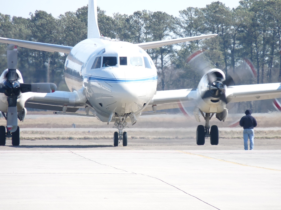
The NASA P-3B at Wallops Flight Facility before the IceBridge check flight on Mar. 14, 2013. Credit: NASA / Kyle Krabill

Similarly, the team tests the DMS instruments to make sure the camera is aligned properly and that focus and frame rate are set appropriately. The rate at which the DMS camera captures photos depends on the aircraft’s speed and altitude, with lower altitude and higher speeds needing a faster rate to ensure proper coverage.

On Mar. 15, the team took off in the morning to do final checks of the P-3B’s radar instruments. Instead of flying along the beaches near Wallops, the P-3 headed out 200 nautical miles over open water in the Atlantic Ocean. The reason for doing this test over the ocean is twofold. First, U.S. law prevents IceBridge from operating its radars inside the country, and second, the ocean surface acts almost like a mirror for the radar, making it ideal for testing. By comparing transmit and return signal strengths at different altitudes, the team can make sure the radar is working properly.
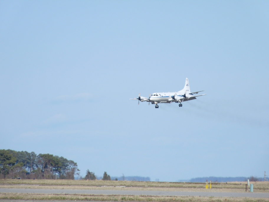
The P-3B returns to Wallops after the first of two IceBridge check flights. Credit: NASA / Kyle Krabill

Signal strength, however, is only part of the picture. MCoRDS is made up of several antennas in an array, with each antenna’s signal recorded separately. To make sure that each element is aligned correctly, the P-3B climbs to a high altitude and banks left and right while researchers measure how the return signals change during the maneuver. These maneuvers are also the reason why the radars are tested on a separate day from ATM and DMS. Once the plane banks more than 15 degrees, its wing blocks these instruments from seeing GPS satellites in orbit and both ATM and DMS need accurate GPS data to work properly.

With the check flights complete it is nearly time for IceBridge scientists, instrument team members and flight crew to make the trip to Thule, Greenland, to start the 2013 Arctic campaign. The P-3B is scheduled to make the transit flight from Wallops early on the morning of Mar. 18, and the first science flight is scheduled for Mar. 20.

Preparations for Arctic Campaign Under Way

By George Hale, IceBridge Science Outreach Coordinator, NASA Goddard Space Flight Center

An IceBridge field campaign is the culmination of months of planning and preparation. At January’s science team meeting, scientists focused the campaign’s goals and provided mission planners the details needed to finalize flight plans. With these final details ironed out the next step was to start preparing the tools of the trade, IceBridge’s aircraft and instruments. For the past several days, instrument teams and aircraft technicians at NASA’s Wallops Flight Facility in Wallops Island, Va., have been getting the P-3B ready for the 2013 Arctic campaign, which is scheduled to have its first science flight on Mar. 20.

Operation IceBridge is but one of several missions to use NASA’s P-3B airborne laboratory. After each mission, this aircraft returns to its home base at Wallops where it undergoes repairs and routine scheduled maintenance needed to keep it flying at peak efficiency and where science instruments are swapped out. This rotation of airborne science missions keeps the Wallops aircraft team busy, preparing between three and five missions per year. “Sometimes it’s more and sometimes it’s less,” said P-3B flight engineer Brian Yates. “We’re working on some relatively large projects, so we have five this year.”

NASA's P-3B airborne laboratory in a hangar at Wallops Flight Facility as it is being prepared for the upcoming Arctic campaign.

NASA’s P-3B airborne laboratory in a hangar at Wallops Flight Facility as it is being prepared for the upcoming Arctic campaign. Credit: NASA / George Hale

After the aircraft’s maintenance is complete and the previous mission’s equipment has been removed, the IceBridge team starts installing the mission’s suite of science instruments. This process can be generally divided into a few portions: installing the instrument and the equipment needed to control it and collect data, testing the individual instruments and checking to make sure the aircraft and instrument suite work together as they should.

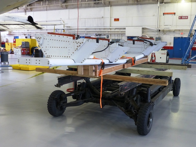
The first step is installing the components that gather the data, such as cameras, radar arrays and laser transceivers. The Airborne Topographic Mapper (ATM) laser and Digital Mapping System (DMS) cameras are installed in bays on the underside of the aircraft. Each of these instruments looks down through windows in the plane’s belly. The Multichannel Coherent Radar Depth Sounder (MCoRDS) antenna is attached to the underside of the aircraft. Previously this has included antennas under the wings, but IceBridge is flying with a trimmed down MCoRDS instrument with an array beneath the P-3B’s fuselage.Additional radar instruments like the accumulation and snow radars and Ku-band radar altimeter are also installed at this time.

The MCoRDS radar antenna on a cart prior to being attached to the underside of the P-3B.

The MCoRDS radar antenna on a cart prior to being attached to the underside of the P-3B. Credit: NASA / George Hale

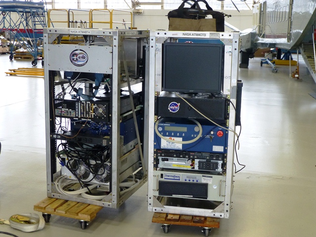
While this hardware was being installed on the plane, other members of the instrument team put together all of the hardware needed to operate the instruments in metal racks that are then securely bolted to the floor of the plane. Making sure everything is securely fastened is crucial because of the often turbulent nature of low-altitude polar survey flights.

ATM equipment racks waiting to be installed in the P-3B.
ATM equipment racks waiting to be installed in the P-3B. Credit: NASA / George Hale

Once everything is in place and secured the next step is to make sure the instruments work properly. This means rounds of testing both on the ground and in the air. Ground testing involves checking instrument connections and alignment. “We’ll check on the camera to make sure it’s seeing through the window ok and not catching the edge,” said DMS field engineer Dennis Gearhart.

Everything being used in this IceBridge campaign has flown before, but it’s important to make sure the instruments are working properly.”We want to make sure things work as well as they did when they were put into storage,” said ATM program manager James Yungel. To do this, the ATM team will bounce the laser off a ground target 500 feet away.

The MCoRDS antenna secured to the underside of the P-3B.

The MCoRDS antenna secured to the underside of the P-3B. Credit: NASA / George Hale

The real test of all this work comes with the mission’s check flights on Mar. 13 and 14. The first flight, known as an engineering check flight is carried out with flight crew only and is to ensure that everything is properly installed and secured. Scientists and instrument operators participate in the second flight, where instruments are powered on and tested. “The check flights are a final arbiter,” said Yungel.

This year’s IceBridge Arctic campaign will run from Mar. 18 through May 3. The P-3B will operate out of airfields in Thule and Kangerlussuaq, Greenland, and Fairbanks, Alaska.

Seeing Data Collection Firsthand

By Donghui Yi, Remote Sensing Scientist, NASA Goddard Space Flight Center

Punta Arenas, Chile is a city with friendly people, rich history, beautiful beach, and spectacular lenticular clouds. Participating in IceBridge’s 2012 Antarctic campaign based at the Punta Arenas airport was an amazing experience for me. I study Airborne Topographic Mapper (ATM) laser waveforms and different tracking algorithms and their influence on elevation measurements. Participating in IceBridge flights let me see ATM instrument setup and operation firsthand.

The flights I was on covered the Antarctic Peninsula, Bellingshausen and Amundsen seas, West Antarctic ice sheet, Weddell Sea, Ronne and Filchner ice shelves and a portion of the East Antarctic ice sheet. The highest latitude we reached was over 86 degrees south. From NASA’s DC-8 aircraft, the beauty of Antarctica’s sea ice, coast, mountains and ice sheets is breathtaking. From a typical survey height of 500 meters above surface, you see an Antarctic you cannot see from surface or from a satellite image. It makes the over 11-hour flight an exciting and enjoyable journey each time.

Antarctic mountains seen from the DC-8
Antarctic mountains seen from the DC-8. Credit: NASA / Donghui Yi

It was also amazing to see the spatial and temporal variability of the clouds over Antarctica, which can go from the surface to several kilometers high and can be continuous or have numerous layers. Even between the surface and a typical survey altitude of 500 meters, there can be so many layers in between, low and high. The IceBridge team and airport meteorologists did an unbelievable job predicting where clear sky regions would be, a critical part for the missions’ success. Without this critical information, the management team would not be able to make the right decisions to determine survey passes.

The flight crew and instrument engineers are wonderful people to work with and their skills and dedication to the project command our utmost respect. The firsthand experience of sea ice and ice sheet data collection is invaluable to my research. This trip itself was a bridge between a scientist and engineers.