First Flight: Across the Getz Ice Shelf


From: Steve Cole, Public Affairs Specialist, NASA Headquarters


PUNTA ARENAS, CHILE – The first flight of Operation Ice Bridge was made from the southern tip of South America on Friday, Oct. 16. The primary target was the Getz Ice Shelf along Antarctica’s Amundsen Coast. The DC-8 flew two parallel tracks along the coast, one just offshore over the floating ice shelf, and one just inland. By measuring on either side of the “grounding line” between the floating ice and the ice on land, scientists can determine the rate at which this near-shore part of the ice shelf is melting.


This target area was selected from the series of flights planned because weather forecasts showed that this was the only clear area available. The low-altitude Getz grounding line paths would allow for a survey of the bottom topography with the MCoRDS instrument, a search for the presence of under-ice water with the gravimeter, and ice surface topography measurements with the ATM laser instrument.


The plane took off at 9:11 a.m. local time with 31 people onboard, including a videographer with the Associated Press. The DC-8 flew at 35,000 feet on the ocean transit to Getz. During this part of the flight, the LVIS laser and the DMS mapping camera made observations of the sea ice. The DC-8 covered 1630 nautical miles before getting to its science targets in Antarctica.


The DC-8 descended to about 1500 feet just east of the Scott Peninsula to begin the low-altitude observations. At the end of the flight path over the Getz Ice Shelf, the plane turned out over the sea ice, which was characterized by open water.


The DC-8 then flew up the DeVicq Glacier to an elevation of about 5,000 feet. Returning to the onshore survey line, the pilots were able to fly the entire line with clear skies. We completed a total of 3.5 hours of low-level flight. The ATM team reported collecting about 200 million laser measurements during the flight. The DC-8 landed at about 9 pm.  Total flight time: 11 hours, 45 minutes.


— Based on reports from Seelye Martin (University of Washington) and James Yungel (NASA Wallops Flight Facility)
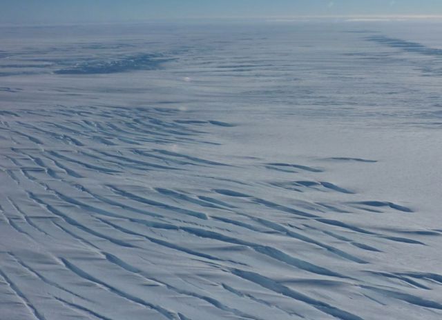


Getz Ice Shelf at low altitude (Photo courtesy Seelye Martin)
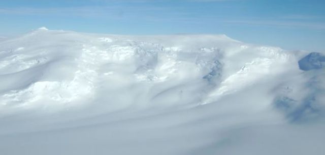


Mount Kauffman at the head of the DeViqc glacier (Photo courtesy John Yungel)


Antarctic sea ice from 20,000 feet. (Photo courtesy John Arvesen)


Getting You Behind the Scenes


From: Steve Cole, Public Affairs Specialist, NASA Headquarters, Washington, D.C.


The last time I was on NASA’s big DC-8 “flying laboratory,” I never got off the ground.


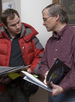
It was a bright April day last year in Fairbanks, Alaska. There was fresh snow on the runway and a wind chill of about 0 degrees Fahrenheit. I was helping journalists get behind the scenes of NASA’s airborne campaign to see how air pollution factored into climate changes across the Arctic. The DC-8 was filled with scientists and instruments and reporters – Associated Press, National Public Radio, the Fairbanks Daily News-Miner – on our media tour of the plane at the city’s airport. (In the photo, I’m the helpful one on the right.)


That’s what we do in NASA’s Office of Public Affairs: help get the word out to the press and public about the cutting-edge science, technology, and exploration that U.S. taxpayers sponsor through our civilian space agency. My slice of NASA is the Earth Sciences Division. Although I usually work this beat from behind a desk, once in a while I get to head outside when NASA launches a new Earth-observation spacecraft or takes to the field to do some science.


Now I’m no scientist (English major, thank you), but I’ve been writing about what scientists do for over 20 years. What fascinates me about the whole endeavor is the ingenious ways these men and women find to see things that haven’t been seen before. Who has seen a continent-sized ice sheet change before? I mean, how do you do that? Well, they find a way.  It’s an amazing and fun thing to watch.


And with Operation Ice Bridge, I might finally be able to watch scientists doing their work from the air. The DC-8 flight managers tell me there should be enough spare seats for reporters and public affairs types like me to fly along over Antarctica. If that works out, I’ll be sharing the experience with you using the new media tools we now have available: Twitter, YouTube, Flickr, and this blog.


Look for my live reports from Punta Arenas, Chile, starting Oct. 16.


YouTube Brings You to Chile


From: Steve Cole, Public Affairs Specialist, NASA Headquarters


PUNTA ARENAS, Chile — Did you know we are posting behind-the-scenes videos of Operation Ice Bridge on NASA Television’s YouTube channel? There are 4 “webisodes” online now in the Ice Bridge collection, with more to come.  It’s a great chance to see for yourself how science is done in the field (and in the air).


https://www.youtube.com/NASATelevision


The View Over Pine Island Glacier


From:  Steve Cole, Public Affairs Specialist, NASA Headquarters

PUNTA ARENAS, Chile — Here are some views from inside NASA’s DC-8 research aircraft during the mission’s Oct. 20 flight to Pine Island Glacier.


Monitors allowed everyone onboard to see where the DC-8 was during the nearly 11-hour roundtrip flight over Antarctica.  (NASA/Steve Cole)


Icebergs breaking off of the glacier in Pine Island Bay as the DC-8 completes one of its mapping runs over Pine Island Glacier.  (NASA/Steve Cole)


The DC-8 makes a turn over Pine Island Bay as it heads back up the glacier for another mapping run.  (NASA/Jane Peterson, NSERC)


Operation Ice Bridge project scientist Seelye Martin from the University of Washington during the flight.  (NASA/Jane Peterson, NSERC)