By George Hale, IceBridge Science Outreach Coordinator, NASA Goddard Space Flight Center
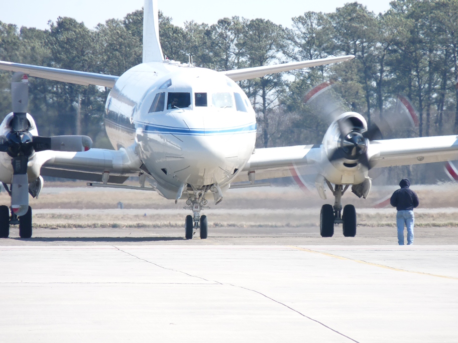
An IceBridge field campaign is the culmination of months of planning and preparation. At January’s science team meeting, scientists focused the campaign’s goals and provided mission planners the details needed to finalize flight plans. With these final details ironed out the next step was to start preparing the tools of the trade, IceBridge’s aircraft and instruments. For the past several days, instrument teams and aircraft technicians at NASA’s Wallops Flight Facility in Wallops Island, Va., have been getting the P-3B ready for the 2013 Arctic campaign, which is scheduled to have its first science flight on Mar. 20.
Operation IceBridge is but one of several missions to use NASA’s P-3B airborne laboratory. After each mission, this aircraft returns to its home base at Wallops where it undergoes repairs and routine scheduled maintenance needed to keep it flying at peak efficiency and where science instruments are swapped out. This rotation of airborne science missions keeps the Wallops aircraft team busy, preparing between three and five missions per year. “Sometimes it’s more and sometimes it’s less,” said P-3B flight engineer Brian Yates. “We’re working on some relatively large projects, so we have five this year.”

NASA’s P-3B airborne laboratory in a hangar at Wallops Flight Facility as it is being prepared for the upcoming Arctic campaign. Credit: NASA / George Hale
After the aircraft’s maintenance is complete and the previous mission’s equipment has been removed, the IceBridge team starts installing the mission’s suite of science instruments. This process can be generally divided into a few portions: installing the instrument and the equipment needed to control it and collect data, testing the individual instruments and checking to make sure the aircraft and instrument suite work together as they should.
The first step is installing the components that gather the data, such as cameras, radar arrays and laser transceivers. The Airborne Topographic Mapper (ATM) laser and Digital Mapping System (DMS) cameras are installed in bays on the underside of the aircraft. Each of these instruments looks down through windows in the plane’s belly. The Multichannel Coherent Radar Depth Sounder (MCoRDS) antenna is attached to the underside of the aircraft. Previously this has included antennas under the wings, but IceBridge is flying with a trimmed down MCoRDS instrument with an array beneath the P-3B’s fuselage.Additional radar instruments like the accumulation and snow radars and Ku-band radar altimeter are also installed at this time.
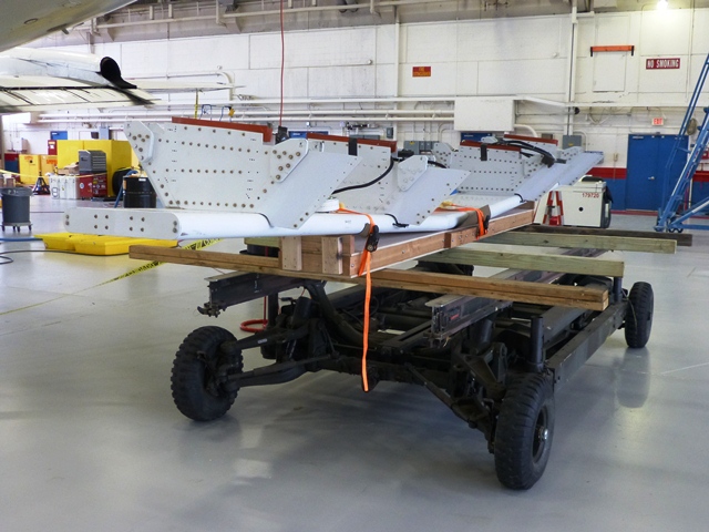
The MCoRDS radar antenna on a cart prior to being attached to the underside of the P-3B. Credit: NASA / George Hale
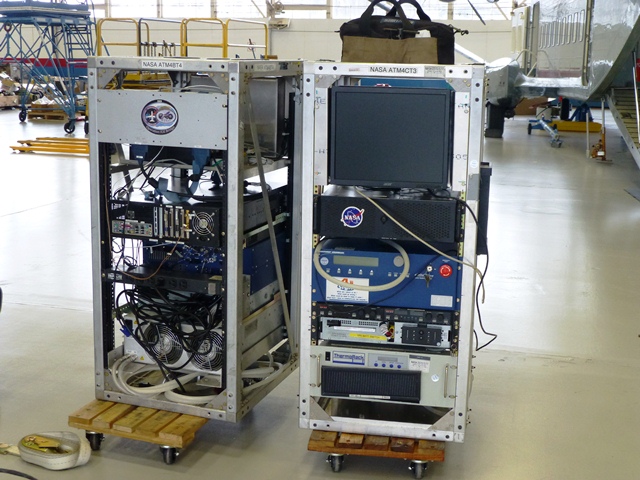
While this hardware was being installed on the plane, other members of the instrument team put together all of the hardware needed to operate the instruments in metal racks that are then securely bolted to the floor of the plane. Making sure everything is securely fastened is crucial because of the often turbulent nature of low-altitude polar survey flights.
ATM equipment racks waiting to be installed in the P-3B. Credit: NASA / George Hale
Once everything is in place and secured the next step is to make sure the instruments work properly. This means rounds of testing both on the ground and in the air. Ground testing involves checking instrument connections and alignment. “We’ll check on the camera to make sure it’s seeing through the window ok and not catching the edge,” said DMS field engineer Dennis Gearhart.
Everything being used in this IceBridge campaign has flown before, but it’s important to make sure the instruments are working properly.”We want to make sure things work as well as they did when they were put into storage,” said ATM program manager James Yungel. To do this, the ATM team will bounce the laser off a ground target 500 feet away.

The MCoRDS antenna secured to the underside of the P-3B. Credit: NASA / George Hale
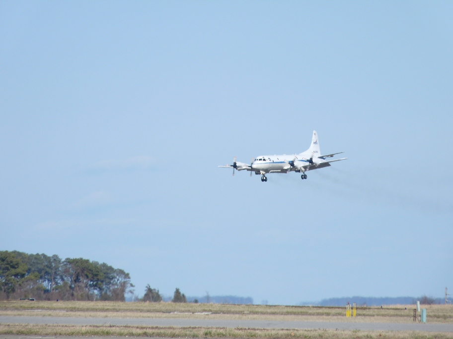
The real test of all this work comes with the mission’s check flights on Mar. 13 and 14. The first flight, known as an engineering check flight is carried out with flight crew only and is to ensure that everything is properly installed and secured. Scientists and instrument operators participate in the second flight, where instruments are powered on and tested. “The check flights are a final arbiter,” said Yungel.
This year’s IceBridge Arctic campaign will run from Mar. 18 through May 3. The P-3B will operate out of airfields in Thule and Kangerlussuaq, Greenland, and Fairbanks, Alaska.
By Michael Studinger, IceBridge Project Scientist, NASA Goddard Space Flight Center/UMBC
Wallops Flight Facility, Wallops Island, VA – Welcome to the fourth annual Arctic campaign with NASA’s Operation IceBridge. Over 75 days, we will collect data with two aircraft over the Greenland Ice Sheet, the Arctic Ocean and the Canadian ice caps. We will be based in Kangerlussuaq and Thule Airbase in Greenland, and in Fairbanks, Alaska for sea ice flights over the Beaufort Sea.
During the past several weeks, Operation IceBridge teams have worked at NASA’s Wallops Flight Facility on the eastern shore of Virginia, installing cutting-edge laser altimeters and extremely sensitive radars that will allow us to measure changes in sea ice thickness in the Arctic Ocean. We will also be monitoring changes in the thickness of ice sheets and glaciers that cover most of the subcontinent of Greenland and the Canadian Arctic Archipelago. We will start our campaign with NASA’s P-3B Orion research aircraft from Wallops at Thule Airbase in northern Greenland with sea ice missions over the Arctic Ocean. The extent and thickness of the sea ice cover in the Arctic Ocean is declining quickly and we are there to take measurements that document this change from year to year. The second plane in this year’s Artic campaign, a Falcon HU-25 jet operated by NASA’s Langley Research Center in Hampton, Va., will join the campaign later in April carrying the Land, Vegetation, and Ice Sensor (LVIS), a high-altitude laser altimeter capable of measuring a 2-km-wide (1.2-mile-wide) swath.

The P-3B aircraft inside the hangar at NASA’s Wallops Flight Facility in Virginia. Credit: Michael Studinger.
Before we can start collecting data over the Artic we have to make sure that all installed sensors on the P-3 work and are calibrated. In order to make extremely precise laser altimeter measurements of the ice surface elevation we calibrate the instruments using target sites at the Wallops Flight Facility that we have surveyed on the ground. A second test flight takes us out over the Atlantic Ocean, some 200 miles away from the coast, where we can switch on the radar systems from the Center for Remote Sensing of Ice Sheets (CReSIS) at the University of Kansas, without interfering with other systems. We use the radar signal that is bouncing back from the ocean surface to calibrate the radars. We also did a couple of maneuvers at high-altitude over the Atlantic to calibrate the antennas of the ice-penetrating radar systems that we will use to survey the sea ice, glaciers and ice sheets.
Research flying has little in common with everyday air travel. One of the maneuvers that we do during the test flights is to fly the aircraft at a 90° roll angle with the wings perpendicular to the horizon. Fasten your seat belts! You will (hopefully) never experience something like this on a commercial flight.

The P-3B on the ramp before a test flight. The antennas of the ice-penetrating radar system can be seen mounted under the wings. Credit: Michael Studinger.
We are collaborating with other experiments such as CryoVEx, the CryoSat-2 calibration and validation campaign from the European Space Agency. We will also work closely together with teams that work on the ground and take measurements over sea ice in the Arctic Ocean, and do coordinated flights with an ER-2 high-altitude aircraft from NASA’s Dryden Flight Research Center in Edwards, Calif. The ER-2, a civilian research version of the Air Force’s U-2 , will carry the Multiple Altimeter Beam Experimental Lidar (MABEL). The ER-2 will fly out of Keflavik, Iceland, and climb to 60,000 feet on its way to Greenland to measure the same tracks as the P-3B Orion.
We have now completed all our test flights here at Wallops and are ready to go to Greenland where we hope to map much of the sea ice cover over the Arctic Ocean and the Greenland Ice Sheet.