The Return of a Chilean Native


From: Jill Hummels, Public Information Officer, University of Kansas School of Engineering

The far tip of Chile is no stranger to one member of the Operation Ice Bridge team.  It’s almost home.

Victor Jara Olivares – an electrical engineering doctoral student, graduate research assistant and native of Concepción, Chile – is among the University of Kansas team members who’ll be in Punta Arenas for the NASAs mission.


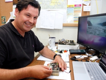
Jara has been involved in making improvements to the MCoRDS radar and supporting additional radars KU is supplying for the mission. He’s also been integral to the development of another radar to be used by in Antarctica later this season for a National Science Foundation Center for Remote Sensing of Ice Sheets (CReSIS) mission.


As an officer in the Chilean Navy, Jara was involved with the Center for Scientific Studies of the South of Chile and has been to Punta Arenas before.  In 2002, while managing a naval air base, Jara helped NASA secure the use of a P3 aircraft.


That exchange put him in touch with Prasad Gogineni, distinguished professor at KU and director of CReSIS, and fostered his interest in remote sensing and polar studies. Freshly armed with master’s degrees in both aerospace engineering and electrical engineering, he was encouraged to pursue a doctorate and was offered a GRA position at KU. It didn’t hurt that his fiancée (now his wife) also was from Kansas.


Jara excitedly shares travel tips and insight to his native culture with anyone who’ll listen.  He offers three “musts” for any leisure traveler to Chile:


• Drink a pisco sour

• Eat a local empanada

• Visit Laguna San Rafael


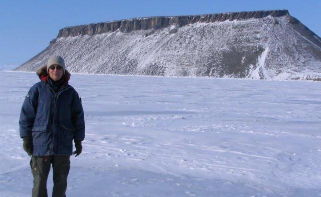
During Ice Bridge, Jara plans to focus on radar work and forego any family visits. Chile, he points out, is as long as the United States is wide, and the 1,600 hundred-mile drive from Punta Arenas to visit his parents would take days.


Inside the DC-8: Instrument Test Flight


From: Nick Frearson, Gravimeter Instrument Team, Lamont-Doherty Earth Observatory


The flight engineer ticks off instruments over the intercom. “LVIS, ready.” “Gravity, ready.” “DACOM, ready.”


We are about to take the DC-8 on its first test flight before Antarctica. The pilots, clipped and professional, have just described the day’s flight plans and the plane is bustling with people making last-minute adjustments.


Suddenly we are ready to go. The city of Palmdale, Calif., drops away as the plane climbs and circles. The dried up lake bed that is home to Dryden and Edwards Air Force Base spreads out below, giving us a Google-Earth view of the area.


We head west over the hills and Los Angeles, indistinct through the haze, and out over the Pacific Ocean. The gravimeter in front of me and Stefan purrs quietly. The aim of the flight is to test and calibrate the laser altimeter – the Laser Vegetation Imaging Sensor (LVIS) – which will measure the surface elevation of the ice sheet.


At 28,000 feet we perform a series of maneuvers to sweep the laser beam back and forth beneath the aircraft. The LVIS engineer is talking to the flight engineer over the intercom while he aligns the instrument. I can hear static, whistles and pops over their voices but nothing that appears to be interfering with our instruments.


To my left an instrument samples the air as we fly along. Melissa, who built the equipment a few days ago, watches pressure gauges and tweaks the dials. Outside, I can see Catalina Island surrounded by clear water. The LVIS engineer announces that he is happy with the laser so we turn for home.


We pass over the smog of L.A., mountains still scarred from the recent forest fires, and the Mojave Desert, where the clear air allows you to see for miles. Back on the ground we head for flight debrief.


Sean downloads the gravity and GPS data that will tell us how well the gravimeter performed. First indications are looking good.


Snapshots: Final Preparations


Ice Bridge science team members at the NASA Dryden flight operations facility in Palmdale, Calif., took these photos of their final preparations in the days before departing for Chile. – Steve Cole, NASA Public Affairs


The Gravity Team from the Lamont-Doherty Earth Observatory of Columbia University on Sunday, Oct. 11 catching the last sun rays outside the NASA hangar a few hours before departing on the DC-8 for Chile. From left: Stefan Elieff (Sander Geophysics), Michael Studinger (Lamont-Doherty), Nick Frearson (Lamont-Doherty), Sean O’Rourke (Sander Geophysics). Photo by Michael Studinger.


Scientists checking their equipment inside the DC-8 before last week’s final science test flight at Dryden. Photo by Nick Frearson (Lamont-Doherty).


University of Kansas graduate student Lei Shi tests the Multichannel Coherent Radar Depth Sounder (MCoRDS) VHF-band radar system in loopback mode during the transit portion of a recent system check flight. Photo courtesy Chris Allen (Univ of Kansas)


Getting You Behind the Scenes


From: Steve Cole, Public Affairs Specialist, NASA Headquarters, Washington, D.C.


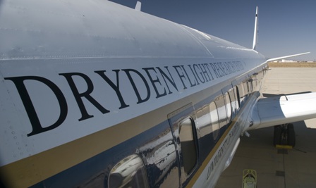
The last time I was on NASA’s big DC-8 “flying laboratory,” I never got off the ground.


It was a bright April day last year in Fairbanks, Alaska. There was fresh snow on the runway and a wind chill of about 0 degrees Fahrenheit. I was helping journalists get behind the scenes of NASA’s airborne campaign to see how air pollution factored into climate changes across the Arctic. The DC-8 was filled with scientists and instruments and reporters – Associated Press, National Public Radio, the Fairbanks Daily News-Miner – on our media tour of the plane at the city’s airport. (In the photo, I’m the helpful one on the right.)


That’s what we do in NASA’s Office of Public Affairs: help get the word out to the press and public about the cutting-edge science, technology, and exploration that U.S. taxpayers sponsor through our civilian space agency. My slice of NASA is the Earth Sciences Division. Although I usually work this beat from behind a desk, once in a while I get to head outside when NASA launches a new Earth-observation spacecraft or takes to the field to do some science.


Now I’m no scientist (English major, thank you), but I’ve been writing about what scientists do for over 20 years. What fascinates me about the whole endeavor is the ingenious ways these men and women find to see things that haven’t been seen before. Who has seen a continent-sized ice sheet change before? I mean, how do you do that? Well, they find a way.  It’s an amazing and fun thing to watch.


And with Operation Ice Bridge, I might finally be able to watch scientists doing their work from the air. The DC-8 flight managers tell me there should be enough spare seats for reporters and public affairs types like me to fly along over Antarctica. If that works out, I’ll be sharing the experience with you using the new media tools we now have available: Twitter, YouTube, Flickr, and this blog.


Look for my live reports from Punta Arenas, Chile, starting Oct. 16.


Satellite Laser Fires Up for Campaign


From: Kathryn Hansen, Science Writer, NASA Goddard Space Flight Center


On Wednesday, Sept. 30, engineers, scientists and mission operations personnel gathered around a single computer monitor tucked away in a corner of a building at NASA Goddard Space Flight Center in Greenbelt, Md. They were waiting for an indication that communication was established between the satellite ground station in Boulder, Colo., and NASA’s Ice, Cloud, and land Elevation Satellite (ICESat) in orbit. Once a connection was made, scientists can “command on” one of the satellite’s lasers and resume the collection of critical ice elevation data.

ICESat has been collecting elevation information of Arctic and Antarctic ice sheets and sea ice since 2003, but it’s uncertain how much longer the satellite’s last of three lasers will operate. So, scientists this fall are using ICESat to calibrate similar measurements from aircraft flights over targets in Antarctica during Operation Ice Bridge. The aircraft campaign will help bridge the data gap until ICESat-II is launched.

As the satellite made a first pass over Antarctica at about 4:15 p.m. EDT, a glitch in communications foiled the first contact. The satellite’s next pass over Antarctica gave ground station managers at University of Colorado’s Laboratory for Atmospheric and Space Physics in Boulder, Colo., enough time to fix the glitch.

At 5:50 p.m., station connection with the satellite was a success and “all commanding was executed as planned,” said David Hancock of Wallops Flight Facility in Wallops Island, Va., instrument manager for the satellite’s GLAS instrument that houses the lasers.

“We now have two ‘laser on’ campaigns per year,” said Shelley Thessen, of ICESat mission operations at Goddard. “It’s a common occurrence, but I still get a lump in my throat every time.”

Subsequent passes over Antarctica were also successful. Scientists have started analyzing the science data returned from the first pass, seen in the figure above as a blue line across central Antarctica.

“On this first pass, there was a small amount of thick cloud cover over the ice sheet,” said Jay Zwally, ICESat project scientist at Goddard. “Accurate measurements of the surface elevation were obtained from 93 percent of the 23,297 laser pulses over the ice sheet.”


Flying the Antarctic: The Trouble with Weather


From: Seelye Martin, Chief Scientist, Operation Ice Bridge


The issue of forecasting weather conditions over Antarctica presents a serious challenge to the Operation Ice Bridge DC-8 flights that get underway in just two weeks.

In the Southern Hemisphere, the Antarctic Ocean is unique in that the Antarctic Peninsula (the focus of many of our flights) is the only north-south oriented land barrier. Within this region, five or six weather systems accompanied by clouds and strong winds, rotate rapidly around the continent from west to east. The clouds from these systems extend from the ocean to the ice sheet, and are associated with strong winds. These systems are partially blocked by the mountains on the Peninsula that rise to approximately 10,000 feet (3,000 meters). Between these weather systems, periods of clear sky occur.

(See for yourself. Here is a link to one Antarctic forecast tool I’ve been using: http://www.mmm.ucar.edu/rt/wrf/amps.  After opening the first page, click on “animations” at the top left; in the next frame select “cloud base” under the first pull-down menu on the left. The image above is a sample of what you’ll see.)

The challenge in planning the flights is that we require clear weather over the target area to operate the lasers. For aircraft safety, we also need to avoid severe storms.


We will obtain our forecasts by working with the Chilean weather service, with polar scientists from the Centro de Estudios Cientificos (Center for Scientific Studies), by examination of satellite imagery downloaded at the airfield, and by use of web-based forecasts.


Another mission challenge is that as it proceeds, our ability to obtain a cloud-free flight decreases. This occurs because at the beginning of the flight series, we have a variety of geographically dispersed targets, such as the sea ice in the Weddell and Amundsen seas, the Peninsula glaciers, and the ice sheet in the vicinity of Pine Island and Thwaites glaciers. This gives us geographic flexibility and the ability to choose a cloud-free region from many different sites. As the flights proceed, the number of our target sites decrease, and finding cloud-free conditions over the target will become more difficult.


Communicating 'Wondrous' Research Efforts


From: Jill Hummels, Public Information Officer, University of Kansas School of Engineering

In August, my boss sent me an email with the subject line of “FYI.” I know what he really meant to type was “Great Opportunity.” In the email he asked if I would be willing to travel to the southern tip of Chile to report on the activities of a University of Kansas research team.

My response: “I carry my passport with me at all times … Yes.”

As a public information officer for the KU School of Engineering, I work with people who do truly wondrous things that few others outside the school or the field know much about. My job is to ensure more people know the wondrous, seemingly magical, research efforts of our faculty.

This time I’m following the adventures of KU researchers who’ve developed radars and computer models that can tell the world a lot about what’s happening to our polar ice. Not a bad gig. The KU team, housed at the Center for Remote Sensing of Ice Sheets and led by Professor Chris Allen, was selected by NASA to provide much of the instrumentation for Operation Ice Bridge. Also, not a bad gig.

I’ve traveled to most states and visited many Canadian provinces and a few Mexican states, but this is my first trip outside North America. I’m pretty excited about the opportunity to travel to Punta Arenas, so much so that a 29-hour flight itinerary seems like a pretty cool endurance test. I guess it’s good that I like to fly. That finely honed skill will come in handy if I’m able to sit in on a flight over Antarctica in NASA’s DC-8.

My family is pretty pumped about my Chile excursion, too, although we haven’t broken the news to the dog, yet. We think she might be jealous.


Thinking on Your Feet on the Ice


From: Nick Frearson, Gravimeter Instrument Team, Lamont-Doherty Earth Observatory


Hi there! I’m senior engineer at Columbia University’s Lamont Doherty Earth Observatory in New York, and my role in Operation Ice Bridge is to work with the gravimeter. This instrument can see beneath ice sheets into the water and bedrock below to reveal the hidden shape of this part of the ice sheet – critical information for predicting how ice sheets will change as the climate warms.


I see the importance of the poles as an indicator of change. There you can see how sensitive the environment is and how easy it is to upset its delicate balance. Changes to the ice sheets at the poles will change sea levels and climate around the world.


I have traveled to both poles and like the wildlife, solitude and shear expansiveness of these amazing places that remind me constantly of how fragile life is. I enjoy thinking on my feet and solving problems with limited resources — so different from our normal civilized lives.


On my last trip to Antarctica, we mapped a huge and remote ice-covered mountain range in the middle of the continent, trying to understand how and when the ice sheets formed. Inside my tent I could hear the constant whispering of the wind over the snow, mixed with the music of Radiohead, Coldplay, Snow Patrol, Imogen Heap, among many others.


I miss my friends when I’m away. Two summers ago, I went to Canada’s Ellesmere Island with my good colleague, Michael Studinger, to test gravity instruments near the North Pole. The island is stunning with windswept hillsides leading down to frozen fjords. I walked for miles across the island, observing Musk Ox and wolves go about their lives. Back at camp, I enjoyed listening to other scientists talk about their travels.


I hope that you enjoy reading about our exploits flying over Antarctica as much as I’ll enjoy taking part in them.


Nick Frearson from the Lamont-Doherty Earth Observatory

“at home in his snow hole near Mount Erebus,

Antarctica, Christmas 2008.”


A New Way to Experience Antarctica


From: Michael Studinger, Instrument Co-Principal Investigator, Lamont-Doherty Earth Observatory 


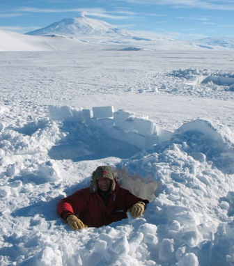
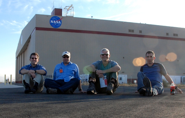
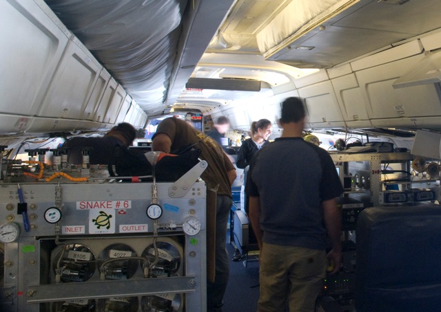
The scale and style of Operation Ice Bridge will be a new experience for me. I’ve been involved in airborne research for more than a decade using ice-penetrating radar systems, airborne laser scanning, gravity and magnetics to learn more about the polar ice caps and how they behave.


In previous airborne campaigns we have used small instrumented Twin Otter aircraft and operated out of remote field camps deep in the interior of Antarctica and at high elevations and extreme temperatures. This means living and working in tents for months at temperatures around -20 to -40°F and flying in unpressurized aircraft at high altitude. There are no showers and only limited communications with the outside world in these remote field camps.


The Ice Bridge campaign will be very different from that. We’ll be flying non-stop roundtrips on the large NASA DC-8 from Punta Arenas, Chile. It feels a bit strange to be flying over Antarctica without actually setting foot on the continent and experiencing firsthand the icy cold and breathtaking beauty of the polar landscape. During Ice Bridge we will have to enjoy the fascination of the polar environment from a heated and pressurized aircraft cabin.


I am a research scientist at Columbia University’s Lamont-Doherty Earth Observatory in New York. My background is airborne geophysics which I use to study the ice caps and the Earth’s crust in polar regions. For Ice Bridge, I’ll be involved in measuring the Earth’s gravity field to estimate how deep the water is beneath floating glaciers along the Antarctic Peninsula.


I’m looking forward to a relaxed airborne campaign, where you leave from Punta Arenas in the morning and return to civilization in the evening.


The Road to Antarctic Science


Welcome to the Operation Ice Bridge blog.


This new NASA mission is the largest airborne survey of polar ice ever flown.  It is also the most sophisticated, using the latest scientific instruments to give an unprecedented three-dimensional view of the ice sheets, floating ice shelves, and sea ice of both the Arctic and Antarctic.


In this blog you’ll hear from a wide range of people involved in Ice Bridge as the mission begins its new expedition: flying over western Antarctica in NASA’s DC-8 starting in October. The base of operations is Punta Arenas, Chile, at the very southern end of South America.


– Steve Cole, NASA Office of Public Affairs, Washington, D.C.


From: Seelye Martin, Chief Scientist, Operation Ice Bridge


Seelye Martin, University of Washington, in Thule, Greenland this May. Mt. Dundas is in the background. Credit: Sinead Farell


I first got involved in polar studies in 1970, when I was hired as an assistant professor at the University of Washington in Seattle. At the university, I did a variety of cold room experiments on sea ice, then took part in a large number of sea ice studies in the Beaufort and Chukchi Seas using land-based helicopters.


Later, working from the NOAA ship Surveyor and Coast Guard icebreaker Westwind, I participated in several cruises studying the sea ice of the Bering Sea, serving as chief scientist on two of these cruises. I also worked in the field and laboratory on the mechanics of how spilled oil interacts with sea ice, and made use of satellite data to study the large-scale sea ice behavior. This research led to my coming to work at NASA Headquarters in Washington, D.C., in 2006 as Cryospheric Program Manager and then to my current role as chief scientist of the Ice Bridge campaign.


One reason that I took the position at NASA and am continuing with the Ice Bridge work is my concern over the diminishing Arctic sea ice cover and the recent accelerating losses from the Greenland and Antarctic ice sheets. The excitement for me in helping to plan and run this campaign is to participate in the design of experiments to replace the observations made by the aging NASA ICESat satellite, and to focus airborne observations on the rapidly changing regions of the Greenland and Antarctic ice sheets.


For the Antarctic flights, we have a comprehensive suite of instruments: lasers for the ice surface elevation, ice-penetrating radar for the bedrock topography, snow radar for snow thickness on sea ice, a gravimeter to measure the shape of seawater-filled cavity beneath the ice tongues, a digital mapping camera to measure three-dimensional relief, and a variety of precision navigation tools to determine where we are and to allow us to follow the ICESat tracks.


This instrument suite should lead to a unique set of ice sheet and sea ice observations. And by comparing the measured ice elevations with previous ICESat tracks, we’ll be able to determine the rates at which the critical glaciers are losing volume.