IceBridge Field Work – A Project Manager's Perspective

By Christy Hansen, IceBridge Project Manager, NASA Goddard Space Flight Center

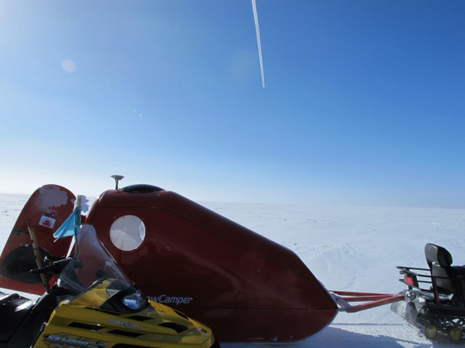
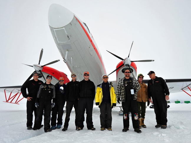
Field work in the Arctic is a unique and challenging experience. It takes an experienced and tough team to complete mission objectives from start to finish despite the biting cold, long days and noisy environment. Early morning temperatures are often in the negative single digits, and the IceBridge team powers through it preparing for flight each day. A typical day’s work can range 12 to 14 hours, a schedule that is repeated daily until the airport is closed or until the flight crew reaches a required hard down day.

My project management perspective allows me to take a step back and appreciate not only the technical expertise of our instrument and flight crew teams, but the masterful choreography that unwinds each day to ensure the P-3B aircraft is prepped and ready, the instruments are powered on and in working condition, and the weather and corresponding science flight plan has been assessed and defined. Being actively involved in all phases of Operation IceBridge makes for a stronger and well-versed leader better able to assist any part of the team at any time. By doing this, I can ensure we are on track to meet our mission and science requirements, assist with troubleshooting in and out of the field, better manage project milestones, and ensure streamlined communication across all IceBridge disciplines with a common goal.

IceBridge project manager Christy Hansen on the stairway to NASA's P-3B.
IceBridge project manager Christy Hansen on the stairway to NASA’s P-3B. Credit: NASA / Christy Hansen
But why do we do this? How do we do this? 

We do all of this in the name of science, collecting polar geophysical data that will help characterize the health of the Arctic and Antarctic. The in-field data and derived data products IceBridge produces are helping to show annual changes in the ice. These data can be entered into models that can more accurately predict what might happen in the future in terms of ice sheet, glacier, and sea ice dynamics, and ultimately sea level rise; all of which have serious consequences for climate change.

But how do we reach these science goals? The steps and teamwork required are simply astounding. Each part of our team is like a puzzle piece and everyone is needed to complete the puzzle. All teams must clearly know their individual responsibilities, but also be able to work together and mesh where their job ends and another begins.

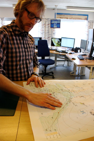
The choreography starts in the beginning, or planning phase where the science team establishes targets of interest on the ice in accordance with our level 1 science requirements. Then our flight planner designs survey flights, having a unique ability to efficiently mesh the science targets with the range and flight dynamic capabilities of the P-3B aircraft.

Next the aircraft office at NASA’s Wallop’s Flight Facility prepares the P-3B for deployment to some of the harshest environments on Earth and supplies the flight crew that executes the specific flight paths over our required science targets. The instrument teams provide the instrumentation—laser altimeters, radars, cameras and a gravimeter and magnetometer—and expertise in operating equipment and processing data during and after flights. Our logistics team deploys to the field ahead of time, establishing security clearances, local transportation and accommodations, and internet and airport utilities.

Finally, our data center ingests and stores the data that our team collects, ensuring it’s useable and available to the wider community. Our data is not only used by polar scientists and other researchers around the world, it is also used to help satellite missions like the European Space Agency’s CryoSat-2 and NASA’s ICESat-2 calibrate and validate satellite instrumentation.

A view of ice from NASA's P-3B airborne laboratory.

A view of ice from NASA’s P-3B airborne laboratory. Credit: NASA / Christy Hansen

And finally, a day in the field …

Assuming a standard 8 a.m. local takeoff and eight hour mission duration, we generally have three major groups who follow different schedules pre-flight each morning.

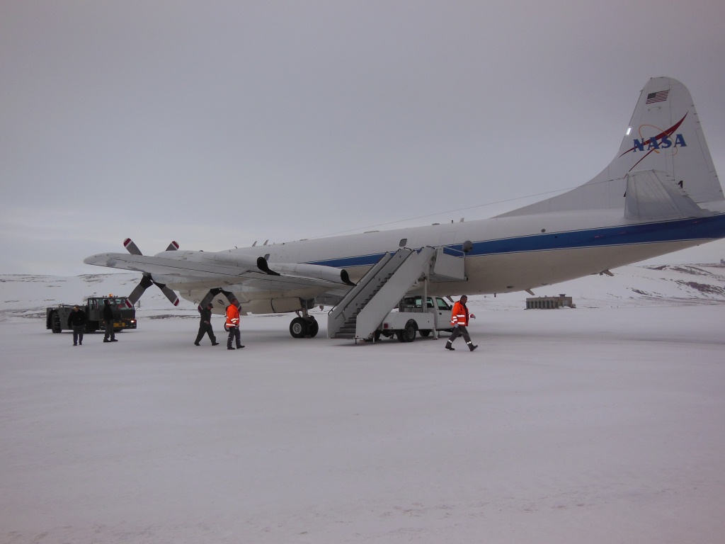
The P-3 maintenance and flight engineer crew typically starts the earliest, heading to the airport about three hours before takeoff. They prep and warm up the plane, conduct some tests and fuel it, all in preparation for the instrument team arrivals and flight operations.

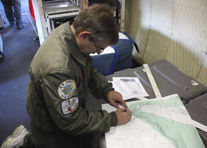
In parallel with aircraft prep, IceBridge’s project scientist, project manager and flight planner team head to the weather office. The team works with local meteorologists, reviewing satellite imagery and weather models to determine the optimal weather patterns that support our flight requirements—clear below 1500 feet, the altitude we typically fly—and final target selection.

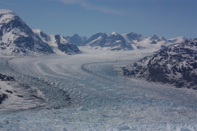
In the meantime, the instrument teams arrive at the aircraft to power up and check their systems prior to takeoff. By 7:30 a.m., the aircraft doors close, and we take off by 8. Our eight-hour flights range between flying high and fast, to low and slow over our targets, which include geophysical scans of ice sheets, glaciers, and sea ice.

We typically land around 4 p.m., close out the plane, check data and meet at 5:30 for a science meeting. Many folks continue to work for a few hours afterward, processing data or writing mission reports. All of this is repeated daily, for up to 6 days in a row, which can be exhausting, but in the name of important scientific research, an amazing team, and majestic polar landscapes, I could not imagine anything else.


Crew members working on the P-3B. Credit: NASA / Christy Hansen

IceBridge the subject of interest at two meetings

By George Hale, Science Outreach Coordinator, NASA Goddard Space Flight Center

Operation IceBridge has been a subject of interest over the past two weeks in different parts of the world, with a presentation in Copenhagen on the mission’s recent work and the Antarctic campaign science operations meeting in Seattle.

At a meeting of the U.S.-Denmark-Greenland Joint Committee in Copenhagen on June 13, U.S. Embassy public affairs officer Robert Kerr delivered a presentation on the cooperative education and outreach efforts that took place during the 2012 Arctic campaign. During his presentation, Kerr talked about the joint effort between NASA, embassy personnel, and people from the Danish and Greenlandic education ministries to provide a research experience for Danish and Greenlandic teachers. He also spoke on their work getting journalists on board the NASA P-3B and showed examples of upcoming articles by a Danish reporter.

The IceBridge science and instrument teams held their 2012 Antarctic campaign planning meeting in Seattle from June 20-22. The meeting featured speakers from the IceBridge science and instrument teams, the Cryospheric Sciences Laboratory at the NASA Goddard Space Flight Center and from NASA headquarters. There were also planning sessions for the upcoming Antarctic campaign. Speakers talked about the various IceBridge instruments, the 2012 Arctic campaign, NASA’s overall vision for IceBridge, the future of the mission and the status of ICESat-2, scheduled for launch in early 2016.

Science and instrument team members at the Antarctic campaign planning meeting at the University of Washington in Seattle.

IceBridge science and instrument team members at the Antarctic campaign planning meeting at the University of Washington in Seattle. Credit: Hajo Eiken/ University of Alaska – Fairbanks.

During the breakout planning sessions, team members summarized the collected mission plans for Antarctica, identified the need for additional missions and discussed future directions and potential new measurement requirements. The IceBridge science meeting is one of many steps on the way to the Antarctic campaign scheduled to start later this year.

The LVIS 86 Pole Flight

From: Scott B. Luthcke, Geophysicist, NASA’s Goddard Space Flight Center

November 4, 2010, 8:05 p.m. EDT

After several days without flights due to unfavorable weather over Antarctica, the Operation Ice Bridge DC-8 is in flight supporting its latest mission. The mission today is the LVIS 86 pole flight. It’s a long 12-hour mission during which the DC-8 will navigate around the South Pole following an arc of -86 deg. latitude at an altitude of 35,000 feet. The South Pole arc will enable NASA’s Land, Vegetation and Ice Sensor (LVIS) to map the surface of the interior of the ice sheet with a 2-kilometer-wide swath, and 25-meter spatial resolution within the swath. This mission will extend the coverage around the pole first collected by LVIS during a 2009 mission. In addition to LVIS, NASA’s Digital Mapping System (DMS) will also be collecting data during this flight. Two other instruments, NASA’s Airborne Topographic Mapper and Kansas University’s MCoRDS radar, typically operate only at lower altitudes, but today both are experimenting with new operational modes and equipment that may allow them to collect data from higher altitudes with LVIS.

The LVIS surface height mapping data provide an important datum to calibrate measurements of ice sheet surface elevation obtained from the Ice Cloud and land Elevation Satellite (ICESat) laser altimeter. ICESat was in a near-polar orbit with the laser altimeter surface profiles densely converging in an arc around the south pole at -86 deg. Therefore, the swath of data LVIS is collecting today, along with that collected in the 2009 pole arc flight, intersects nearly 70 percent of ICESat orbits and provides over a million LVIS and ICESat difference observations for comparison. It’s a unique set of data leveraging the converging satellite tracks around the pole. In addition, the LVIS observations will provide an important datum to monitor long-term interior ice sheet change with respect to current and future near-polar satellite mission data. The DMS and MCoRDS systems complement and enhance the LVIS data by providing high-resolution surface imagery and bedrock topography respectively.

Principal investigator Bryan Blair and scientist Michelle Hofton are running LVIS for today’s mission. Through the magic of technology, lead instrument engineer David Rabine is supporting the mission via xchat while he is on an airplane flying back to the United States after spending the previous three weeks in the field with the instrument. LVIS obtains measurements of surface height using a laser altimeter approach. A laser pulse is transmitted from the instrument, and is reflected back from the surface where the return pulse is recorded. The distance, or range from the instrument to the reflecting surface, is computed as the round trip time of flight of the pulse divided by two (to get the one-way travel time) and then divided by the speed of light. GPS receivers are used to compute the position of the instrument, while the pointing or direction of flight of the laser pulse is determined using instrument orientation data provided by a gyro attitude sensor. The surface elevation for each laser shot can then be computed from these data using the position of the instrument, the direction of the laser pulse travel and the distance or range of the laser pulse travel to the surface.

Credit: NASA/Michael Studinger

Nearly 30 minutes into the flight the excitement ramped up as the pilots prepared to perform the LVIS instrument calibration maneuver. Everyone took their seats and strapped in. A few minutes later the go was given to perform the maneuver and the airplane pitched up and down several times followed by several rolls left and right, giving us all a roller coaster ride. After a few minutes all was clear and we were back to business.

Now, over six hours into the mission we have completed the data collection for the pole arc and are heading back to Punta Arenas, Chile. On the transit back we flew directly over the South Pole! The mission was clearly a success with mostly clear skies and a full data collection from the instruments. Everyone is looking forward to getting on the ground, having a good dinner, and getting rested up for, potentially, another flight tomorrow.

The South Pole Station was easily visible during a flight there on Nov. 4. Credit: Digital Mapping System (DMS) group

The Big Three

From: Kathryn Hansen, NASA’s Earth Science News Team/Cryosphere Outreach Specialist

KANGERLUSSUAQ — The evening before the second science flight, IceBridge scientists Michael Studinger and John Sonntag visited Kangerlussuaq’s weather office — a small building adjacent to the town’s grocery store. Weather can make or break a mission, as clouds interfere with instruments’ ability to map the ice.

This time there was another factor to contend with. Ash from Iceland’s Eyjafjallajokull volcano had made its way over the southeast side of Greenland. Comparing the proposed flight path with the position of ash, IceBridge crew decided the flight was a “go.”

Mission managers selected the Helheim-Kangerd flight plan, which called for mapping two of three glaciers deemed “the big three.” (The third is Jacobshavn, to be surveyed in a separate mission).

Helheim and Kangerdlugssuaq glaciers are quickly accelerating, speeding up ice loss to the ocean. Steep beds and the influence of saltwater working its way under the glaciers are thought to be playing a role. Annual data collected during IceBridge will help scientists maintain a record of the ice loss and learn more about the factors driving the change.

After mapping Kangerdlugssuaq, the P-3 passed over a ground team on an expedition collecting ice cores. The overflight was intentional — multiple sources of data over a single location can prove useful for calibrating data and for research. Similarly, IceBridge flights frequently reexamine tracks previously observed by the ICESat satellite. The ice coring crew was caught on camera (below) by the Digital Mapping System — a digital camera mounted in the underbelly of the P-3.

Moment of Truth at Summit Camp

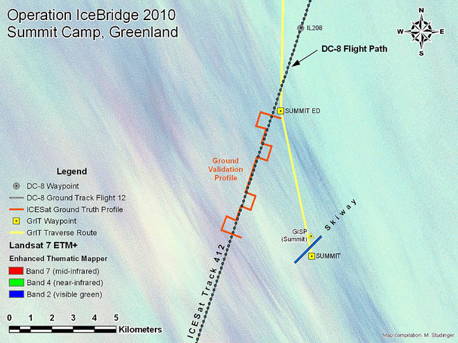
IceBridge mission planners plot some flight lines to match the location — and sometimes the timing — of measurements collected on the ground or from satellites. This “ground-truthing” technique helps scientists calibrate and interpret air- or space-based measurements. On April 14, IceBridge flew along a previous track from the Ice, Cloud, and land Elevation Satellite (ICESat), while at the same time scientists at Summit Camp collected ground-based data. Christina Hammock and Sonja Wolter share some images from the event, and provide a look inside the life of a “Summit Camp techie.”

We had been anticipating this flight for almost a month because we were timing some ground-truthing measurements to coordinate with the flight (more below). We had near-daily contact with John Sonntag for a few weeks prior to the flight over Summit Camp. It took a while, but both the weather and the logistics finally came together for the flight on Wednesday, April 14.

Sonja Wolter(right) from Summit Camp in Greenland was working in the field when NASA’s DC-8 passed overhead. Credit: Christina Hammock

Summit Camp is a research station dedicated mainly to atmospheric and climate research. There are only five people on station during the winter months, which is divided into three phases, late August to early November, early November to early February, and early February to late April. During the summer (late April to late August), the station population goes up to 25-50 researchers and support staff (starting a week from today with the arrival of an LC-130 bringing about 25 people – ack!)

Our crew includes a Station Manager — Ken Keenan; a heavy equipment operator — Geoff Miller; a power plant mechanic — Luke Nordby; and the two of us — the Summit science technicians. When we have an involved task like the IceBridge coordination, everyone helps get us out the door.

Gear for the IceBridge and ICESat transect at Summit Station included two snowmobiles, an emergency snow camper, a GPS system and a bamboo pole to make the measurement. Credit: Sonja Wolter

As science techs, we carry out and maintain all the ongoing experiments at or near camp. One of these experiments is the ICESat transect, which is (or was) a ground-truthing measurement for the now-defunct ICESat. The Summit ICESat transect is a zigzagging path of bamboo poles that underlies one of the swaths of the icecap that an ICESat overpass used to include. Once per month, we manually measure the snow depth at the poles and also get exact GPS coordinates at these spots.

To do this, we drive two snowmobiles out and cruise (well, putt putt) along the line poles (at -35 F this week). We don’t know for sure, but we’re guessing the round trip is about 8 miles, and it takes us 2.5 to 3 hours. Although the ICESat instruments are no longer working, we have carried on with the transect measurements to continue the data set for this snow accumulation study. This month’s measurements had the extra bonus of being coordinated with IceBridge for verification of their measurements.

During the winter, the last brush with the outside world (not including the world wide web and telephone, that is) is the Twin Otter flight that comes to pick up the outgoing crew after a week of turnover. So, seeing the NASA DC-8 plane was the first reassurance that people are in fact still out there. Maybe we are geeks, but it was exciting and fun for us to be a part of the IceBridge project.

On April 14, 2010, NASA’s DC-8 flew over Summit Camp, Greenland. Credit: Christina Hammock

When not on the ice, Sonja Wolter works full-time as the operations coordinator for NOAA’s Carbon Cycle/Greenhouse Gases group in Boulder, Colo. Christina Hammock works in Space Science Instrumentation at the Johns Hopkins Applied Physics Lab in Laurel, Md., and formerly worked in the Laboratory for High Energy Astrophysics at NASA’s Goddard Space Flight Center. 

The downward-looking Digital Mapping System camera captured an image of what scientists think is the ground crew from Smmit Camp.Credit: NASA

NASA Readies for Spring 2010 Ice Bridge Campaign

From: Kathryn Hansen, Science Writer, NASA’s Earth Science News Team


Credit: John Sonntag/Wallops Flight Facility

In August 2008, NASA scientist John Sonntag, of NASA’s Wallops Flight Facility in Wallops Island, Va., captured this view of a small iceberg as it moved down the Narsarsuaq fjord in southern Greenland. “I spent about half an hour watching that little berg, which was in the process of disintegrating during the time I was watching,” Sonntag said. “It went from a complete, small berg to a collection of floating ice rubble within that small span of time. The place was so quiet that the noise of the berg softly coming apart was the only sound present.”

Sonntag’s observation took place during the 2008 NASA and Center for Remote Sensing of Ice Sheets (CReSIS) airborne deployment in Greenland. This spring, Sonntag and other scientists return to the Arctic for big picture and little picture views of the ice as part of NASA’s six-year Operation Ice Bridge mission — the largest airborne survey of Earth’s polar ice ever flown — now entering its second year. The project team is finalizing flight paths over Greenland’s ice sheet and surrounding sea ice, where scientists will collect measurements, maps and images from a suite of airborne instruments. Such information will help scientists extend the record of changes to the ice previously observed by NASA’s Ice, Cloud, and land Elevation Satellite (ICESat), while uncovering new details about land-water-ice dynamics.

NASA aircraft have made numerous science flights over Greenland, most recently during the spring 2009 Ice Bridge campaign and also in 2008 as part of the NASA/CReSIS deployment. Smaller-scale airborne surveys have been made by William Krabill, of NASA Wallops, and colleagues nearly every spring since 1991.

Visit the Operation Ice Bridge Web page throughout the spring 2010 campaign for news, images, and updates from the field. Flights from Greenland are scheduled to begin no sooner than March 22.


Satellite Laser Fires Up for Campaign


From: Kathryn Hansen, Science Writer, NASA Goddard Space Flight Center


On Wednesday, Sept. 30, engineers, scientists and mission operations personnel gathered around a single computer monitor tucked away in a corner of a building at NASA Goddard Space Flight Center in Greenbelt, Md. They were waiting for an indication that communication was established between the satellite ground station in Boulder, Colo., and NASA’s Ice, Cloud, and land Elevation Satellite (ICESat) in orbit. Once a connection was made, scientists can “command on” one of the satellite’s lasers and resume the collection of critical ice elevation data.

ICESat has been collecting elevation information of Arctic and Antarctic ice sheets and sea ice since 2003, but it’s uncertain how much longer the satellite’s last of three lasers will operate. So, scientists this fall are using ICESat to calibrate similar measurements from aircraft flights over targets in Antarctica during Operation Ice Bridge. The aircraft campaign will help bridge the data gap until ICESat-II is launched.

As the satellite made a first pass over Antarctica at about 4:15 p.m. EDT, a glitch in communications foiled the first contact. The satellite’s next pass over Antarctica gave ground station managers at University of Colorado’s Laboratory for Atmospheric and Space Physics in Boulder, Colo., enough time to fix the glitch.

At 5:50 p.m., station connection with the satellite was a success and “all commanding was executed as planned,” said David Hancock of Wallops Flight Facility in Wallops Island, Va., instrument manager for the satellite’s GLAS instrument that houses the lasers.

“We now have two ‘laser on’ campaigns per year,” said Shelley Thessen, of ICESat mission operations at Goddard. “It’s a common occurrence, but I still get a lump in my throat every time.”

Subsequent passes over Antarctica were also successful. Scientists have started analyzing the science data returned from the first pass, seen in the figure above as a blue line across central Antarctica.

“On this first pass, there was a small amount of thick cloud cover over the ice sheet,” said Jay Zwally, ICESat project scientist at Goddard. “Accurate measurements of the surface elevation were obtained from 93 percent of the 23,297 laser pulses over the ice sheet.”


ICECAP Investigates East Antarctica


From: Kathryn Hansen, Science Writer, NASA’s Earth Science News Team

Operation Ice Bridge scientists and crew completed 21 successful flights over West Antarctica and returned home in time for Thanksgiving. Still flights over the icy continent continue. Scientists with another field campaign — Investigating the Cryospheric Evolution of the Central Antarctic Plate, or simply ICECAP — are making ongoing airborne investigations over East Antarctica.


The ICECAP Casey/DDU survey team at Casey from left to right: Dean Emberley (KBA), Jamin Greenbaum (Texas), Jorge Alvarez (Texas), Andrew Wright (Edinburgh), Duncan Young (Texas), Young Gim (JPL), Dave Meyer (KBA), Noel Paten (AAD), Ray Cameron (KBA); not pictured Glenn Hyland (AAD). Credit: Todor Iolovski (Bureau of Meteorology)


ICECAP, for which NASA’s Ice Bridge is funding some of the flights, is an international collaboration with principal investigators from University of Texas at Austin’s Jackson School of Geosciences, the University of Edinburgh, and the Australian Antarctic Division. The goal is to use airborne instruments to chart ice-buried lowlands, which could show how Earth’s climate changed in the past and how future climate change will affect global sea level.

Where have they flown and what have they observed? ICECAP’s University of Texas researcher Duncan Young provided some updates from the field:

Dec. 8, 2009

Right now we are preparing to begin our shift from McMurdo to Australia’s Casey Station via the joint French-Italian base on top of the ice sheet, Concordia, after completing our ICECAP flights out of McMurdo today with Flight 16, right down the maw of Byrd Glacier. Tomorrow we will use our survey plane to move people and cargo to Concordia, surveying all the way, and then return to McMurdo. On Wednesday we will move the rest of our people using our aircraft all the way to Casey from McMurdo. It is a complex multinational ballet, where the timing of weather at locations over 1,250 miles (2,012 kilometers) apart is critical. Then we will begin our ICECAP/Ice Bridge operations out of Casey Station with our Australian colleagues.

Dec. 22, 2009

Using an upgraded DC-3, we have completed five flights, each about seven hours long out of Casey Station, in addition to the 20 flights we completed out of McMurdo Station. Three of these Casey based flights have flown over 2,330 miles (3,750 kilometers) of ICESat tracks, over the rapidly lowering Totten and Denman Glaciers.


Denman Glacier; Credit: Jamin Greenbaum, University of Texas at Austin


T
oday we are conducting an ambitious 10-hour flight to finish off our Casey work for this season. We will be flying to Concordia Station in the center of the ice sheet, picking up fuel and base GPS data we have been gathering over the past ten days to help improve our aircraft positions, and thus the surface elevations we have been measuring.

Then we will fly along a ‘tie-line’ to connect several transects we flew last season to the Dome C ice core. By tracking ice layers in the radar data, we have a chance to find where some of the oldest ice in Antarctica might lie, perhaps more than a million years old. This old ice would contain greenhouse gasses from the past, leading to a better understanding of climate change if it is drilled. The aircraft will then return to Casey station along our last targeted ICESat line along Totten Glacier.

After this flight, we plan to move to Dumount d’Urville Station in time for a French Christmas dinner — if the katabatic winds there allow it …