Meteorologists with the U.S. Space Force’s Space Launch Delta 30 Weather Squadron are predicting a 100% chance of favorable weather conditions for launch, with no primary weather concerns.
Tag: Vandenberg Space Force Base
NASA Updates SWOT Launch Date, TV Coverage
NASA, the French space agency Centre National d’Études Spatiales, and SpaceX now are targeting 3:46 a.m. PST on Friday, Dec. 16, for launch of the Surface Water and Ocean Topography (SWOT) mission.
After SpaceX’s Falcon 9 rocket went vertical on the pad at Space Launch Complex 4 East (SLC-4E) at Vandenberg Space Force Base in California, teams identified moisture in two Merlin engines on the rocket’s first stage booster. Teams completed inspections of the rocket’s engines today, but will use the additional time to complete data reviews and analysis before a launch attempt.
The SWOT satellite is healthy, and the weather forecast remains favorable for liftoff on Friday morning. Live launch coverage will begin at 6 a.m. EST (3 a.m. PST) on Friday on NASA Television, YouTube, Twitter, the NASA app, and the agency’s website.
Launch Readiness Review Complete Ahead of NASA’s DART Mission
A team of launch managers for NASA’s Double Asteroid Redirection Test (DART) mission have authorized approval to proceed to launch countdown at Vandenberg Space Force Base in California ahead of a scheduled launch on Tuesday, Nov. 23 at 10:21 p.m. PST (Wednesday, Nov. 24 at 1:21 a.m. EST) from the SpaceX Space Launch Complex 4.
During the Launch Readiness Review on Nov. 22, launch managers from NASA’s Launch Services Program (LSP), SpaceX, and DART mission team received an update on the mission status and any close-out actions from the previously held Flight Readiness Review. Signing the Certificate of Flight Readiness at the conclusion of the LRR were NASA’s Office of Safety and Mission Assurance; LSP’s chief engineer, launch director, and program manager; the U.S. Space Force’s Space Launch Delta 30 commander; the DART project manager; Johns Hopkins Applied Physics Laboratory director; and the SpaceX Launch Director.
DART is the first mission to test technologies for preventing an impact of Earth by a hazardous asteroid. DART’s target asteroid in not a threat to Earth.
Teams also recently completed integration of the Falcon 9 rocket and its payload. After moving the DART spacecraft, encapsulated in its payload fairings, from the payload processing facility to the Falcon 9 Hangar, SpaceX technicians horizontally integrated the encapsulated spacecraft to the SpaceX Falcon 9 rocket over a two-day period, Nov. 20 to 21.
“The payload mate onto the launch vehicle is an important milestone for DART because it is the final verification to ensure the spacecraft is communicating with its ground team,” said Notlim Burgos, LSP payload mechanical engineer. “This milestone also is significant for the LSP mechanical team because it integrates the last components of the launch vehicle, completing the build of the Falcon 9 in support of NASA’s first planetary defense mission.”
NASA’s Launch Services Program, based at Kennedy Space Center in Florida, is managing the launch. The Johns Hopkins Applied Physics Lab manages the DART mission for NASA’s Planetary Defense Coordination Office as a project of the agency’s Planetary Missions Program Office. The agency provides support for the mission from several centers, including the Jet Propulsion Laboratory in Southern California, Goddard Space Flight Center in Greenbelt, Maryland, Johnson Space Center in Houston, Glenn Research Center in Cleveland, and Langley Research Center in Hampton, Virginia.
Landsat 9 Continues a Legacy of 50 Years
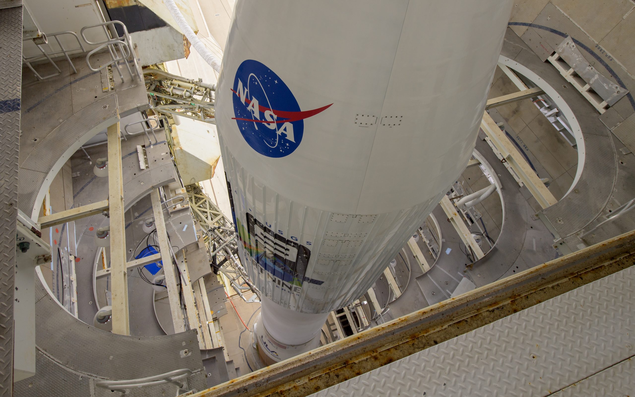
After a United Launch Alliance Atlas V rocket successfully carried the Landsat 9 spacecraft into orbit from Vandenberg Space Force Base in California on Sept. 27, the satellite now joins Landsat 8 in orbit and replaces Landsat 7, launched in 1999.
Landsat 9 and Landsat 8 will collect images from across the planet every eight days. This calibrated data will continue the Landsat program’s critical role in monitoring the health of Earth and helping people manage essential resources, including crops, irrigation water, and forests.
“Landsat provides one basic set of observations that feeds an entire range of Earth science applications and research,” said NASA Landsat 9 Project Scientist Jeff Masek.
Images from Landsat 9 will be added to nearly 50 years of free and publicly available data from the mission – the longest data record of Earth’s landscapes taken from space. Landsat’s medium-resolution imaging capability allows researchers to harmonize the images to detect the footprint of human activities and their impact on our home planet over the decades.
“We have over 2,000 peer-reviewed publications every year in the scientific literature that depend on the Landsat archive,” Masek said. “Landsat is our best source for understanding rates of tropical deforestation, as well as other forest dynamics like disturbances from hurricanes, wildfires, insect outbreaks, as well as the recovery of those disturbances over time.”
As Landsat 9 orbits Earth, it captures scenes across a swath 185 kilometers (115) miles wide. Each pixel in these images is 30 meters across, or about the size of a baseball infield, which allows resource managers to resolve most crop fields in the United States. Its instruments collect images of Earth’s landscapes in visible, near and shortwave (reflected) infrared, and thermal infrared wavelengths. Like its predecessors, Landsat 9 is a joint effort of NASA and the U.S. Geological Survey.
“The USGS collection data allow the science, government, civil, and international user communities to map wildfires, primary and secondary contributions to greenhouse gas emissions, ice cover persistence, melt, water clarity, water quality, floating algae biomass, landcover that’s changed, and also urban growth and the heat island effects on local and regional temperature,” said USGS Project Scientist Chris Crawford. “The USGS 5-year archive provides a highly reliable, highly stable, and high-quality terrestrial and aquatic imaging record that can enable the quantification of space and time effects of climate variability and change on both human and natural systems.”
Since the launch of the first Landsat satellite in 1972, the mission’s archive has grown to contain more than 8 million images. Landsat 9 data will add to this archive to better our understanding of Earth in innumerable ways – from tracking water use in crop fields in the western United States, to monitoring deforestation in the Amazon rainforest, to measuring the speed of Antarctic glaciers. Decision makers from across the globe use the freely available Landsat data to better understand environmental change, forecast global crop production, respond to natural disasters, and more. The usefulness of the data stems from the careful design and engineering of the satellite and the mission.
“Landsat allows us to track in near real time, and in a consistent way, changes to our planet and specifically to our agricultural lands,” said Inbal Becker-Reshef, program director of NASA Harvest, the agency’s food security and agriculture program. “One of the biggest stories of landcover change Landsat has been instrumental to reveal and to track has been the rapid deforestation in the Amazon in South America, in large part driven by agricultural expansion for pastures and croplands. Without Landsat’s historical data archive, we wouldn’t be able to track such massive land changes, which have critical implications for Earth’s ecosystems, biodiversity, and for climate.”
Landsat 9 is designed to last at least five years on orbit but has enough fuel to operate for at least 15 years, including de-orbit, though it could last for 20 or more years. Data from the satellite will become available to the public after completion of the satellite’s 100-day checkout period in January. The next Landsat mission is already in the works, with a series of planned enhancements, including higher spatial resolution, more spectral bands, and more frequent coverage, which are the highest priorities from the Landsat user communities.
To learn more about Landsat 9, visit https://www.nasa.gov/specials/landsat; https://landsat.gsfc.nasa.gov; and https://www.usgs.gov/landsat.
Continue following the mission on social media, and let people know you’re following it on Twitter, Facebook, and Instagram using the hashtag #Landsat and tag these accounts:
Twitter: @NASA, @NASAEarth, @NASA_Landsat, @NASASocial, @NASA_LSP, @NASA360
Facebook: NASA, NASA Earth, NASA LSP
Instagram: NASA, NASAEarth
Landsat 9 Satellite Separates From Second Stage, Traveling on Its Own
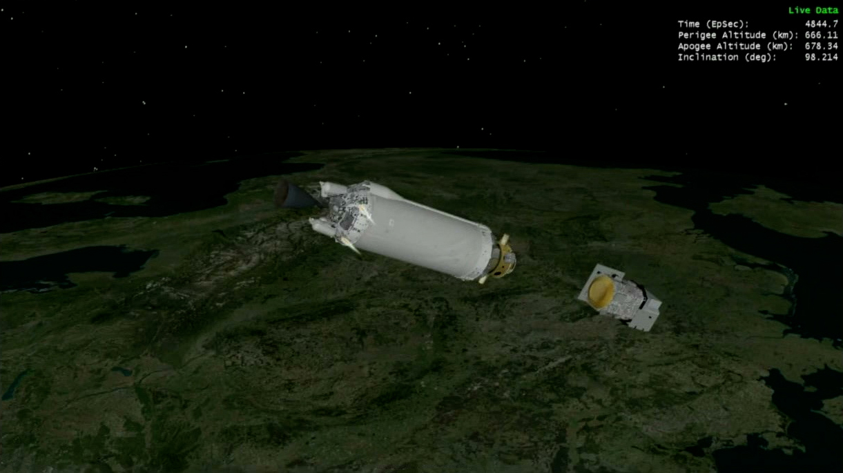
The Landsat 9 satellite has separated from the Centaur second stage.
Once online, Landsat 9 will take its place as the most advanced satellite in the Landsat series and extend the data record of Earth’s land surface that began with the first Landsat satellite in 1972. Landsat’s high-quality scientific data makes multi-decadal time series studies possible, and its data are regularly used for land management efforts around the world.
Landsat 9 Satellite in Coast Phase
The United Launch Alliance Centaur second stage achieved the desired near-polar, sun-synchronous orbit for Landsat 9 just over 16 minutes into flight. It is now coasting to the other side of the Earth to release the spacecraft just over an hour from now.
Landsat 9 Launches!

Landsat 9, powered by the United Launch Alliance Atlas V 401 rocket, has lifted off from Space Launch Complex-3 at Vandenberg Space Force Base in California today, Sept. 27! Launch occurred at 11:12 a.m. PDT (2:12 p.m. EDT).
Launch Director – ‘Go’ For Launch

The launch director has just given the Landsat 9 mission a ‘go’ for launch! Mission and launch managers are counting down to the launch of the United Launch Alliance Atlas V 401 rocket from Space Launch Complex-3 at Vandenberg Space Force Base in California. Launch will take place less than five minutes from now.
Landsat 9 should reach the desired near-polar, sun-synchronous orbit just over 16 minutes into flight. It will then coast over an hour to the other side of Earth before the satellite is released.
Coming Up: Liftoff of the NASA-USGS Landsat 9 Mission
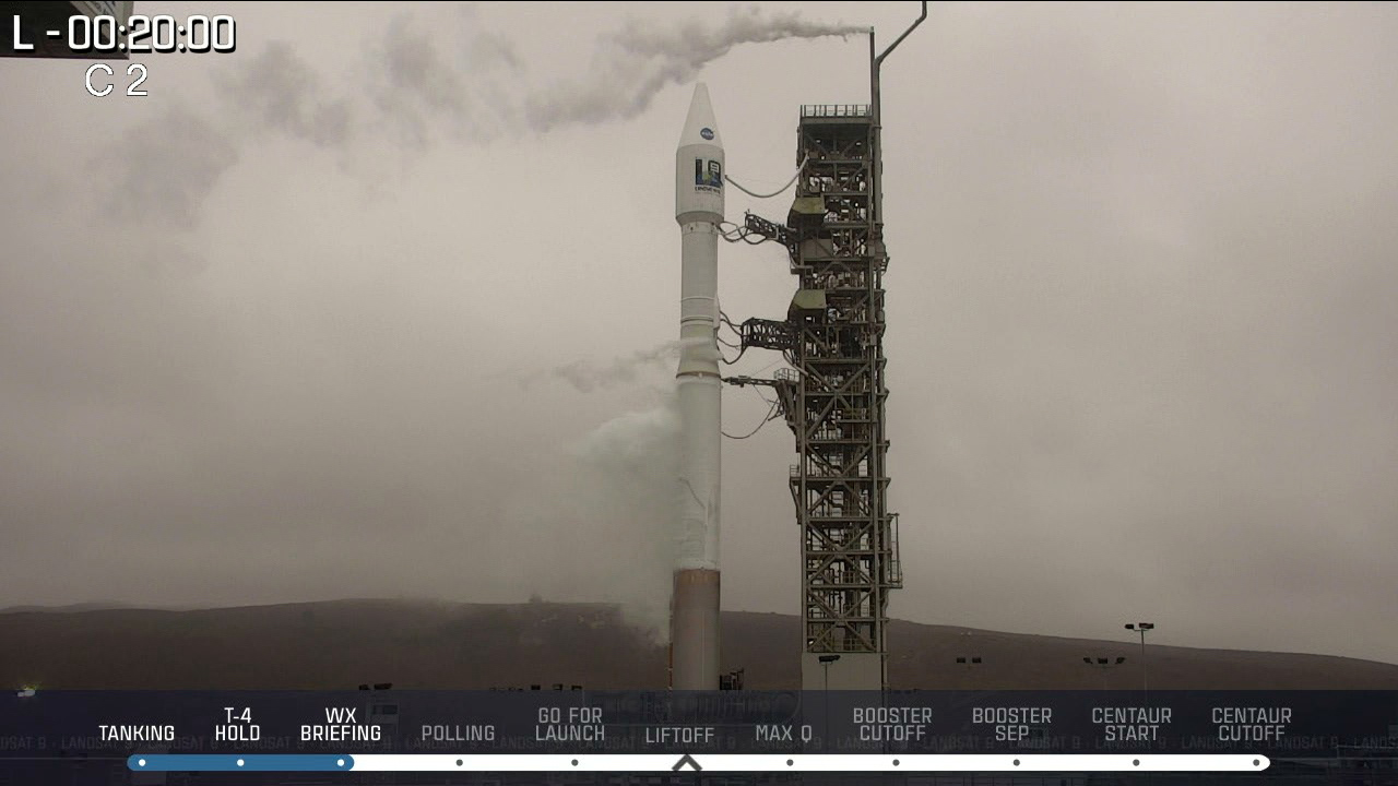
In just over 15 minutes from Space Launch Complex-3 at Vandenberg Space Force Base in California, the United Launch Alliance Atlas V 401 rocket carrying Landsat 9 will rumble to life, sending the NASA-U.S. Geological Survey (USGS) Earth-monitoring satellite on its mission. The fuel fill sequence has been initiated, and the rocket is being fueled with liquid oxygen (LO2) and rocket-grade kerosene (RP-1).
Prior to launch, targeted for 11:12 a.m. PDT (2:12 p.m. EDT), several sequences will be performed to ensure launch success. The fuel fill sequence will be completed, water deluge system actuation pressure adjustment will be performed, the LO2 in the Atlas booster and Centaur second stage will reach flight levels, as well as the liquid hydrogen fuel levels in the Centaur. Final launch polls are conducted and before a go to continue countdown, at which time the spacecraft transfers to internal power and an automatic computer sequencer takes control for all critical events through liftoff. Fuel tanks reach flight pressure, and the Atlas first stage and Centaur second stage switch to internal power. The launch control system is enabled, and ‘go’ for launch is verified before entering terminal countdown.
Landsat 9 will join its sister satellite, Landsat 8, in orbit, collecting images from across the planet every eight days. This calibrated data will continue the Landsat program’s critical role in monitoring the health of Earth and helping people manage essential resources, including crops, irrigation water, and forests. To learn more about how NASA’s Earth science work makes a difference in people’s lives around the world every day, follow @NASAEarth on Twitter, NASA Earth on Facebook, and NASAEarth on Instagram.
Landsat 9: Nextgen of the Landsat Series

Nearly 50 years after the launch of the first Landsat satellite, Landsat 9 strikes a balance using state-of-the-art technology that will collect the highest quality data ever recorded by a Landsat satellite, while still ensuring that these new measurements can be compared to those taken by previous generations of the Earth-observing satellite.
The new satellite will add more than 700 scenes of Earth to the mission’s archive each day. A near-polar orbit will allow the satellite’s sensors to image almost the entire planet every 16 days. When Landsat 9 joins Landsat 8 in orbit, the two satellites together will be able to image each swath of the globe every eight days.
Landsat 9 carries two instruments that largely replicate the instruments on Landsat 8: the Operational Land Imager 2 (OLI-2) and the Thermal Infrared Sensor 2 (TIRS-2).
The OLI-2, built by the Ball Aerospace & Technologies Corporation, measures in the visible, near-infrared and shortwave infrared portions of the spectrum. Its images will have 15-meter (49 ft.) panchromatic and 30-meter multi-spectral spatial resolutions along a 185 km (115 miles) wide swath, covering wide areas of the Earth’s landscape while providing sufficient resolution to distinguish features like urban centers, farms, forests, and other land uses. The entire Earth falls within view once every 16 days due to Landsat 9’s near-polar orbit.
TIRS-2 measures land surface temperature in two thermal bands with a new technology that applies quantum physics to detect heat. The original TIRS instrument was added to the Landsat 8 satellite mission when it became clear that state water resource managers rely on the highly accurate measurements of Earth’s thermal energy obtained by its predecessors, Landsat 5 and Landsat 7, to track how land and water are being used. With nearly 80% of the fresh water in the western U.S. being used to irrigate crops, TIRS and TIRS-2 are invaluable tools for managing water consumption.
The instruments use Quantum Well Infrared Photodetectors (QWIPs) to detect long wavelengths of light emitted by the Earth, whose intensity depends on surface temperature. These wavelengths, called thermal infrared, are well beyond the range of human vision. QWIPs are a new, lower-cost alternative to conventional infrared technology and were developed at NASA’s Goddard Space Flight Center in Greenbelt, Maryland.
The QWIPs, TIRS, and TIRS-2 use are sensitive to two thermal infrared wavelength bands, helping it separate the temperature of the Earth’s surface from that of the atmosphere. Their design operates on the complex principles of quantum mechanics. Gallium arsenide semiconductor chips trap electrons in an energy state ‘well’ until the electrons are elevated to a higher state by thermal infrared light of a certain wavelength. The elevated electrons create an electrical signal that can be read out and recorded to create a digital image.
