From: Nick Frearson, Gravimeter Instrument Team, Lamont-Doherty Earth Observatory
The flight engineer ticks off instruments over the intercom. “LVIS, ready.” “Gravity, ready.” “DACOM, ready.”
We are about to take the DC-8 on its first test flight before Antarctica. The pilots, clipped and professional, have just described the day’s flight plans and the plane is bustling with people making last-minute adjustments.

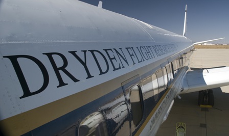
Suddenly we are ready to go. The city of Palmdale, Calif., drops away as the plane climbs and circles. The dried up lake bed that is home to Dryden and Edwards Air Force Base spreads out below, giving us a Google-Earth view of the area.
We head west over the hills and Los Angeles, indistinct through the haze, and out over the Pacific Ocean. The gravimeter in front of me and Stefan purrs quietly. The aim of the flight is to test and calibrate the laser altimeter – the Laser Vegetation Imaging Sensor (LVIS) – which will measure the surface elevation of the ice sheet.
At 28,000 feet we perform a series of maneuvers to sweep the laser beam back and forth beneath the aircraft. The LVIS engineer is talking to the flight engineer over the intercom while he aligns the instrument. I can hear static, whistles and pops over their voices but nothing that appears to be interfering with our instruments.
To my left an instrument samples the air as we fly along. Melissa, who built the equipment a few days ago, watches pressure gauges and tweaks the dials. Outside, I can see Catalina Island surrounded by clear water. The LVIS engineer announces that he is happy with the laser so we turn for home.
We pass over the smog of L.A., mountains still scarred from the recent forest fires, and the Mojave Desert, where the clear air allows you to see for miles. Back on the ground we head for flight debrief.
Sean downloads the gravity and GPS data that will tell us how well the gravimeter performed. First indications are looking good.

580207157
The plane is bueatiful