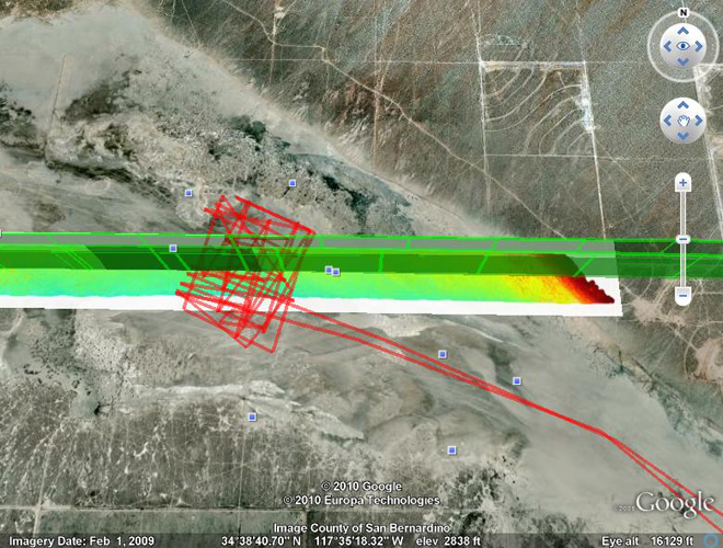
Before the IceBridge crew flew to Thule, Greenland, they performed a test flight on March 17 in California to calibrate the aircraft’s science instruments.

From: John Sonntag, senior scientist with the IceBridge management team, URS Corporation in Wallops Island, Va.
This Google Earth image graphically illustrates one of the many techniques the Airborne Topographic Mapper (ATM) team utilizes to calibrate and validate our instrument.
The image shows El Mirage Dry Lake, about 25 miles east of Palmdale, Calif. We overflew the lakebed three times on the March 17 test flight — the flight paths are shown in green. The extremely detailed elevation measurements made by the ATM are depicted by the multi-colored swath, with warm colors depicting topographic “highs” and cool colors depicting lows. The red path is a survey we conducted of the lake surface with a GPS-equipped vehicle.
By comparing the ATM laser swath measurements with the surface measurements we made using the GPS-equipped vehicle, we can derive a variety of calibration measurements for the ATM, which we use to improve its accuracy and precision, ultimately to the level of a few centimeters. This process has just begun and will be supplemented by many other datasets as we proceed with the campaign.
Another aspect this image illustrates is the extremely high precision of our navigation systems, which are also part of the ATM system. The flight crew “coupled” their autopilot to our precise navigation system for all three of these passes. The result was that all three passes were within just a few meters of each other — pretty impressive when we’re flying at 250 knots!
