Q&A: Michael Studinger

By Maria-Jose Viñas, Cryospheric Sciences Laboratory Outreach Coordinator, NASA Goddard Space Flight Center 

Michael Studinger is Operation IceBridge’s project scientist. He trained as a geophysicist in Germany, his home country, before moving to the U.S. to take a position at the Lamont-Doherty Earth Observatory and then transferring to NASA Goddard Space Flight Center in 2010. Studinger has been studying polar regions for 18 years, expanding his initial focus on the geology and tectonics of the Antarctic continent to the overall dynamic of polar ice sheets.
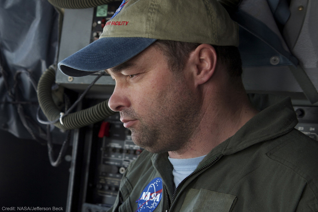
IceBridge project scientist Michael Studinger

Operation IceBridge Project Scientist Michael Studinger. Credit: Jefferson Beck / NASA

Studinger recently returned from Greenland, where he was leading Operation IceBridge’s 2012 Arctic campaign.

This was IceBridge’s fourth Arctic campaign. How different was it from previous years?

We flew more than last year: During the 75 days we were there, we only had to cancel a single flight because of weather, something I’ve never seen before. Regarding sea ice, we have expanded coverage in terms of area. For the first time we went to the Chukchi and Beaufort Seas to collect data there. But the biggest change this year is that we published a new data product that we had to deliver to the National Snow and Ice Data Center before we even returned from the field. This product is being used by modelers and other scientists to make a better prediction of the annual sea ice minimum in the summer. We can now feed ice thickness measurements from March and early April into these predictions and see how they improve them.

What are the benefits of improving Arctic sea ice minimum predictions?

There seems to be enough people who have an interest in finding out how thick or thin the sea ice will be. People who live in the Arctic and shipping companies…they want to know, they want to prepare. It’s like long-range weather forecast: People who grow crops would like to know if they’re going to get a wet season or a dry season.

Also, it’s a relatively short-term prediction, so we’ll soon find out if the models are working or not. It helps building better models because you can compare the results to the reality in a few months.

This Arctic campaign, you teamed up with CryoVEx, ESA’s calibration and validation campaign for the CryoSat-2 satellite. How did it go?

We did two coordinated flights with them. We were in Thule, Greenland, and they were in Alert, Canada. We both took off at the same time and made sure we were over the same point in the Arctic Ocean with CryoSat-2 flying overhead. It was quite a bit of a coordination effort. We measured the same spot along the satellite track within a few hours. The CryoVEx team has instruments similar to ours, but also some that we don’t have. IceBridge has unique instrument suite for sea ice that includes the world’s only airborne snow radar. By combining all the data from all the instruments, we can learn a lot about what each instrument is seeing and what CryoSat-2 is actually measuring over sea ice.

How’s your average Arctic campaign?

We start in Thule because we want to get the sea ice flights out of the way early on, as long as it’s cold over the Arctic Ocean. It’s still fairly dark there, that far north [Thule is 750 miles north of the Arctic Circle]. We have just enough light in the second half of March to fly the sea ice missions, during the first three weeks of the campaign. Then we go down to central Greenland while it’s still cold there and start doing ice sheet flights, for three or four weeks. Then we go back to Thule because it’s getting too warm in southern Greenland, and we finish the ice sheet flights in the northern half.

Can you describe your daily routine while in Greenland?

We get up at 5 a.m. In Kangerlussuaq, we try to be in the air at 8:30, and in Thule we try to be flying at 8, when the airport opens. Eight hours later, we land. After that, we have a science meeting where we talk about how the flight went and the plan for the following day. Then we eat dinner, check email, look at data… all that before we go to bed and do it all over again the next day.

How do Arctic and Antarctic campaigns differ?

We use different aircraft: a P-3B for the Arctic and a DC-8 for Antarctica. In Greenland, when we fly out of Kangerlussuaq or Thule, we start collecting data pretty much right away, except for the sea ice missions. In Antarctica, we “commute” from Punta Arenas in southern Chile, which takes a few hours. Then we can only collect data for a few hours before we go back home to Punta Arenas. Typically, in the DC-8 we fly for 11 to 11.5 hours, much longer than the about 8 hours of flight with the P-3.

We actually fly more instruments on the P-3: the accumulation radar and the magnetometer (which is much easier to install on the P-3 than on the DC-8). We don’t really have the room in the fuselage to mount the accumulation radar antennas and there’s not really much of a need to use it in Antarctica. The snow accumulation in Greenland is higher. We can actually see annual layers with the accumulation radar but it’d be far more difficult in Antarctica because less snow falls there.

Personally, do you prefer one campaign to the other?

No, they’re just different. It’s a different airplane: the DC-8 is much more comfortable, less noisy. You don’t have the vibration of the P-3, so you can actually get a lot of work done on the transit flights. But the flights are very long.

And scientifically, is one campaign more interesting than the other?

Not for me. Most of my work I’ve done in Antarctica, but I’m getting more and more interested in what Greenland has to tell us. If you look at the two biggest glaciers we study, Jakobshavn Isbrae in Greenland and Pine Island Glacier in Antarctica, the kind of mechanism through which both glaciers are losing ice is similar — warm ocean water is melting the ice from underneath. So we’re studying similar processes. Antarctica is far more challenging to get there and collect data, but from a scientific point we need to do both, otherwise we’re missing part of the picture.

What’s the 2012 Antarctic campaign going to look like?

It’s going to be shorter for a number of reasons, mostly because the aircraft has already been committed for an international multi-aircraft experiment in Thailand, and it’s also committed afterward. We’ll try to fly as much as we can, we’ll be using two aircraft: a G-V from the National Science Foundation, flying at high altitude, and NASA’s DC-8 flying low.

What will the future bring for IceBridge?

The plan is we will start using unmanned aerial vehicles and we’ll probably be doing it mostly over sea ice in the Arctic Ocean, but we don’t know the details yet. We will be doing some test flights over the Arctic Ocean later this year with the Global Hawk, either with the radar or laser altimeter onboard. I don’t think we can replace manned aircraft completely over the course of IceBridge.

After ICESat-2 launches, will IceBridge continue to some extent?

There will always be airborne campaigns to some degree, because there are some datasets that we can only collect from planes, and we will also need to calibrate and validate the satellite data. We need a variety of different scales, wavelengths, different types of measurements in order to really answer the science questions that we have, such as what is the contribution of Greenland to sea level rise in the next 20 or 30 years. For example, if we only have ICESat-2 collecting measurements of how the surface elevation is changing, we’ll know a lot, but we’ll never be able to answer with certainty what is causing these changes. It’s almost like you’re taking the pulse of a patient; you’re only looking at the symptoms of the illness without understanding what’s causing it. In order to find out why the ice sheet is changing its surface, we need to understand what’s beneath the ice sheet because that’s what’s driving a lot of the dynamic changes. And those are datasets that you can’t collect from space, you need an airplane to go in there and get the greater picture of what’s below there and other things, like snow accumulation, which can be done much better from airplane. It’s not a single satellite that will provide us the answer, not a single airborne measurement – it all has to come together.

A Spanish version of this post is available on National Public Radio’s Science Friday blog.

Getting Ready for the 2012 Arctic Campaign

By Michael Studinger, IceBridge Project Scientist, NASA Goddard Space Flight Center/UMBC

Wallops Flight Facility, Wallops Island, VA – Welcome to the fourth annual Arctic campaign with NASA’s Operation IceBridge. Over 75 days, we will collect data with two aircraft over the Greenland Ice Sheet, the Arctic Ocean and the Canadian ice caps. We will be based in Kangerlussuaq and Thule Airbase in Greenland, and in Fairbanks, Alaska for sea ice flights over the Beaufort Sea.

During the past several weeks, Operation IceBridge teams have worked at NASA’s Wallops Flight Facility on the eastern shore of Virginia, installing cutting-edge laser altimeters and extremely sensitive radars that will allow us to measure changes in sea ice thickness in the Arctic Ocean. We will also be monitoring changes in the thickness of ice sheets and glaciers that cover most of the subcontinent of Greenland and the Canadian Arctic Archipelago. We will start our campaign with NASA’s P-3B Orion research aircraft from Wallops at Thule Airbase in northern Greenland with sea ice missions over the Arctic Ocean. The extent and thickness of the sea ice cover in the Arctic Ocean is declining quickly and we are there to take measurements that document this change from year to year. The second plane in this year’s Artic campaign, a Falcon HU-25 jet operated by NASA’s Langley Research Center in Hampton, Va., will join the campaign later in April carrying the Land, Vegetation, and Ice Sensor (LVIS), a high-altitude laser altimeter capable of measuring a 2-km-wide (1.2-mile-wide) swath.

The P-3B aircraft inside the hangar at NASA’s Wallops Flight Facility in Virginia.

The P-3B aircraft inside the hangar at NASA’s Wallops Flight Facility in Virginia. Credit: Michael Studinger.

Before we can start collecting data over the Artic we have to make sure that all installed sensors on the P-3 work and are calibrated. In order to make extremely precise laser altimeter measurements of the ice surface elevation we calibrate the instruments using target sites at the Wallops Flight Facility that we have surveyed on the ground. A second test flight takes us out over the Atlantic Ocean, some 200 miles away from the coast, where we can switch on the radar systems from the Center for Remote Sensing of Ice Sheets (CReSIS) at the University of Kansas, without interfering with other systems. We use the radar signal that is bouncing back from the ocean surface to calibrate the radars. We also did a couple of maneuvers at high-altitude over the Atlantic to calibrate the antennas of the ice-penetrating radar systems that we will use to survey the sea ice, glaciers and ice sheets.

Research flying has little in common with everyday air travel. One of the maneuvers that we do during the test flights is to fly the aircraft at a 90° roll angle with the wings perpendicular to the horizon. Fasten your seat belts! You will (hopefully) never experience something like this on a commercial flight.

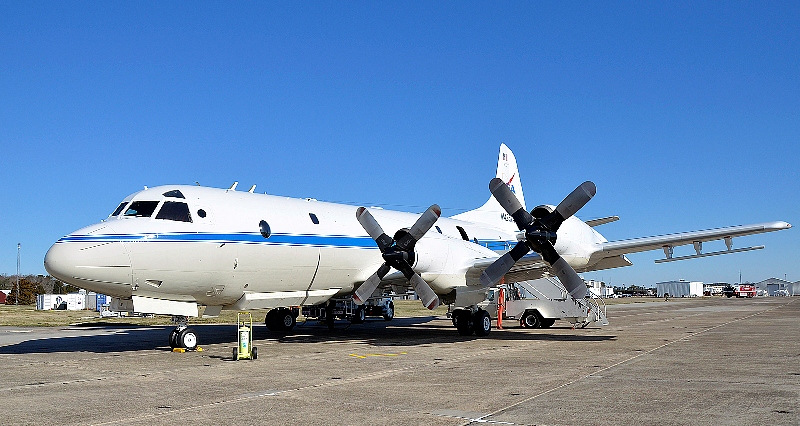
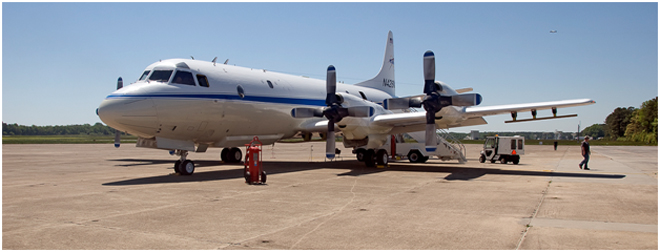
The P-3B on the ramp before a test flight. The antennas of the ice-penetrating radar system can be seen mounted under the wings.

The P-3B on the ramp before a test flight. The antennas of the ice-penetrating radar system can be seen mounted under the wings. Credit: Michael Studinger.

We are collaborating with other experiments such as CryoVEx, the CryoSat-2 calibration and validation campaign from the European Space Agency. We will also work closely together with teams that work on the ground and take measurements over sea ice in the Arctic Ocean, and do coordinated flights with an ER-2 high-altitude aircraft from NASA’s Dryden Flight Research Center in Edwards, Calif. The ER-2, a civilian research version of the Air Force’s U-2 , will carry the Multiple Altimeter Beam Experimental Lidar (MABEL). The ER-2 will fly out of Keflavik, Iceland, and climb to 60,000 feet on its way to Greenland to measure the same tracks as the P-3B Orion.

We have now completed all our test flights here at Wallops and are ready to go to Greenland where we hope to map much of the sea ice cover over the Arctic Ocean and the Greenland Ice Sheet.

An Uncommon Routine

From: Michael Studinger, IceBridge project scientist, Goddard Earth Sciences and Technology Center at the University of Maryland, Baltimore County

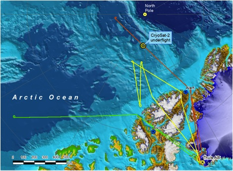
Thule Air Base, Greenland — The IceBridge team arrived in Thule last week and the campaign is off to a good start. We flew four out of five days last week and accomplished three sea ice missions including an underflight of the European Space Agency’s CryoSat-2 satellite over the Arctic Ocean. After a week here in Thule, we are settled in and our operations have become routine.

Operation IceBridge accomplished three science missions during the first week, including an underflight of ESA’s CryoSat-2 over the Arctic Ocean just 120 miles from the North Pole. Credit: NASA

A typical IceBridge day in Thule Greenland starts at 5 a.m. when my alarm clock goes off. I start downloading satellite images to get an idea which missions may be possible to fly before I go to breakfast at 5:45 a.m. At 6:15 a.m., the pilot in command, mission manager, John Sonntag and myself meet at Base Ops to get a weather brief for the day.

The three meteorologists at Thule Air Base have known us for years and do an excellent job in providing us with a very detailed and specialized weather brief that we require for decision making. The demands for research flights are different from everyday air travel, and the polar environment poses great challenges in terms forecasting the weather. There is not a single weather station within hundreds of miles of our survey area that we could use to get a weather observation or that would provide observational data as input into a forecast model. Instead, we depend on satellite images that are several hours old. Visible images are dark for any area west of us. It requires experience and skill to interpret the forecast products for our purpose.

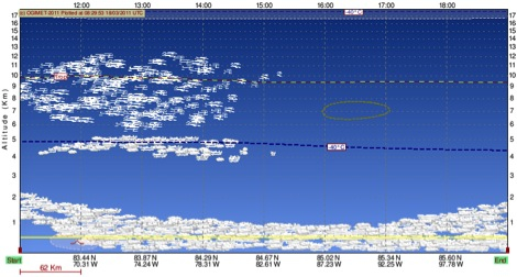
A few days ago, a model transect along our flight path showed dense cloud cover along the entire mission profile at 500 meters flight elevation calling for a no-fly day. We spent time with the meteorologists to understand the weather situation and decided to fly, despite the grim looking forecast. It was the right decision. The cloud layer depicted by the forecast model turned out to be a thin layer of haze that did not pose any difficulties for our laser and digital imagery sensors.

The weather forecast is shown along a survey line for a P-3 science mission. The forecast predicts dense cloud cover at the flight elevation (500 m), but after carefully studying the weather situation, we decided to fly. Credit: NASA

Between 6:30-6:45 a.m. we make a go/no-go decision. If we fly, the aircraft gets pushed out of the hangar and the fuel truck arrives. We need to collect one hour of static GPS data on the ground to calculate high-precision trajectory data from our flights. At 7:30 a.m. the door of the aircraft closes and we taxi to the runway to be ready for an 8 a.m. takeoff as soon as the tower opens.

We typically transit to the survey area north of Thule and then descend to 1,500 feet were we start collecting data. It’s still early in the season, which means missions west of Thule are flown in near-constant twilight, with the sun following us as we go west. When we turn around the western end of the line and fly back east, it immediately start getting lighter with every minute of the flight.

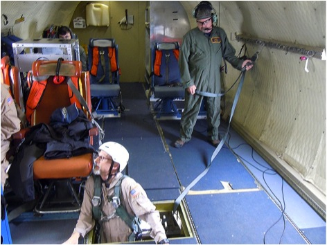
During the flight the operators monitor their instruments and make sure we collect high-quality data. Occasionally, adjustments need to be made to ensure the instruments keep working.

In-flight adjustments are often necessary to keep the instruments working and collecting high-quality data. Adjustments often require work below the deck to access the instrument sensors in the belly of the P-3. Credit: NASA/Michael Studinger

At 3:45 p.m. we typically land to leave enough time for a 1-hour post-calibration with the aircraft outside. By 5 p.m. the aircraft is rolled back inside the hanger and doors close for the night.

John Sonntag and myself quickly stop by Base Ops for another weather brief to see what’s in the mix for the next day. At 5:30 p.m. we have a science meeting where we discuss plans for the next day and talk about issues that are worth sharing with others. After the meeting, most people go straight to dinner followed by a late evening spent backing up data and processing data.

At 5 a.m. the next morning we start again.

A lateral moraine can be seen at the margin of the Greenland Ice Sheet near Thule Air Base. Credit: NASA/Michael Studinger

Rollercoaster of Opportunity

From Kathryn Hansen, NASA’s Earth Science News Team, Goddard Space Flight Center

Nov. 13, 2010

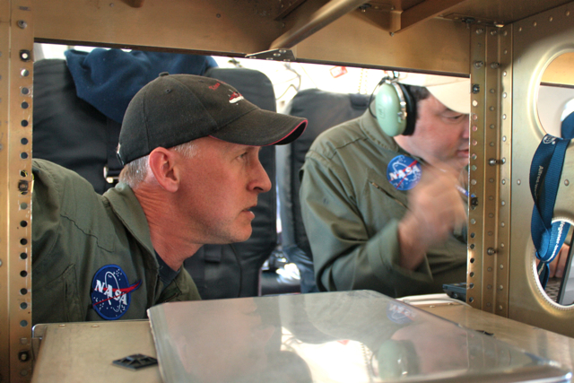
John Sonntag (left), of NASA’s Wallops Flight Facility/URS, and Michael Studinger (right), of NASA’s Goddard Space Flight Center/UMBC, evaluate the Peninsula mission on the fly. Credit: NASA/Kathryn Hansen

PUNTA ARENAS, Chile — Friday evening, IceBridge teams gathered in the hotel conference room to discuss logistics for upcoming flights. First up: weather. The audience watched the animated WRF model, a tool used for flight planning because it tells you what the weather will be like in the next 6-12 hours. On this particular morning, the model showed system after system lined up to pummel Antarctica. “Are we sure this isn’t the WTF model?” a scientists inquired.

Saturday morning, scientist and flight planner John Sonntag arrived at the airport offices with the flight decision. Weather conditions weren’t perfect, but were the best the Antarctic Peninsula had seen in a month. Given that it had been a few days since the last flight and the forecast looked to only worsen in the days ahead, mission planners decided to take the opportunity to fly under the cloud ceiling. The model predicted clear skies below 10,000 feet. “I hope they’re right,” Sonntag said.

The flight planners quickly worked up a modified version of the “Pen 23” flight plan and at 9:23 we took off for the Peninsula.

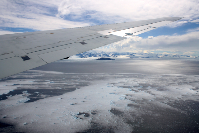
The DC-8 approaches the Antarctic Peninsula. Credit: NASA/Kathryn Hansen

We flew the planned route backward, hitting northern cloud-free regions first. Heading south, we followed the eastern side the “spine” — the crest of a mountain range that extends down the middle of the Peninsula. Unfortunately for stomachs, the spine influences weather patterns and the east side also happened to be the windy, turbulent side. The DC-8 may need to restock the little white bags!

Stomachs also suffered from the dramatic changes in altitude necessary to collect data. The measurements require a relatively consistent altitude, which can be tricky when accessing a glacier behind a rock cliff. But the pilots deftly handled the 7,000-foot-roller coaster flight line to collect data over targets also surveyed during the 2009 campaign.
Glaciers meander through the rocky terrain of the Antarctic Peninsula (right). Credit: NASA/Kathryn Hansen

Targets flown: Hektoria, Drygalski, Crane, Flask and Leppard. Each of these glaciers drain into the Larsen A and B ice shelves which broke apart in 1995 and 2002, respectively. Attlee, Hermes, Lurabee and Clifford. Each of these glaciers drains into Larsen C, which is still intact.

So what? Like a cork in a bottle, ice sheets can plug the neck of a glacier. Remove that ice shelf and the glacier more freely dumps ice into the ocean. Scientists want to keep an eye on how these glaciers continue to respond years and decades after the loss of the shelves. Crane, for example, which feeds into the remnant of Larsen B, shows little sign of slowing down.

Cruising further south, however, we encountered too many clouds so we cut across to the west side of the spine to check out the Fleming Ice Shelf. Clouds there also proved too dense, however, so we turned north back to Punta Arenas. At 8.4 hours, the modified Pen 23 became the shortest flight of the campaign — to the relief of many yellow-faced passengers.

Welcome to the Operation IceBridge 2010 Antarctic Campaign

From: Michael Studinger, IceBridge project scientist, Goddard Earth Science and Technology Center at the University of Maryland


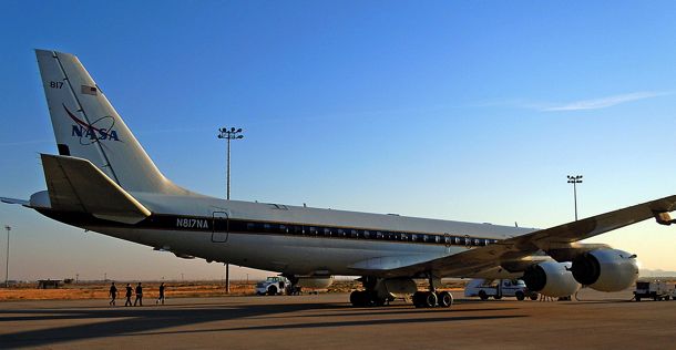
The DC-8, parked outside the hanger at NASA’s Dryden Flight Research Center, is prepared for a instrument test flight. Credit: NASA/Michael Studinger

Oct. 17, 2010

Dryden Flight Research Center, CA — Welcome to our 2010 Antarctic campaign with NASA’s DC-8 Flying Laboratory. For the past two weeks Operation IceBridge teams have been busy installing instruments and sensors onto the DC-8 aircraft here in Palmdale, Calif., at NASA’s Dryden Flight Research Center. Over the next couple of weeks we will fly with the DC-8 over Antarctica to measure changes in thickness of the sea ice surrounding Antarctica and to monitor changes in the thickness of ice sheets and glaciers that cover 98% of the Antarctic continent. 

But before we can go south we have to go through a series of test flights here in California to make sure that all the installed sensors work and to calibrate our science instruments. In order to do this we fly over target sites in the Mojave Desert that we have surveyed on the ground a few days before the test flights. The desert environment that we have selected for our test flights here is very different from the barren land of snow and ice that we will be flying over the next couple of weeks and we all enjoy the low altitude flights over the Mojave Desert, the San Gabriel Mountains and the San Andreas Fault. When the pilots ask you if it would be a problem if the belly of the aircraft is facing the sun you know that you are in the world of research flying. We did a couple of 90 roll maneuvers at high altitude over the Pacific Ocean to calibrate the antennas of the ice-penetrating radar systems that we will use to survey sea ice, glaciers, and ice sheets.
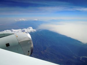
Instrument test flight over the San Gabriel Mountains in California. Credit: NASA/Michael Studinger

The IceBridge teams have enjoyed a few days of work here in warm and sunny California and we are now ready to fly to Punta Arenas in southern Chile, which will be the base of operation for our Antarctic flights. We are looking forward to another successful campaign with exciting new data and spectacular Antarctic scenery.

Back from Greenland, No Rest for the Weary

NASA and university partners returned from Greenland on May 28, concluding Operation IceBridge’s 2010 field campaign to survey Arctic ice sheets, glaciers and sea ice.

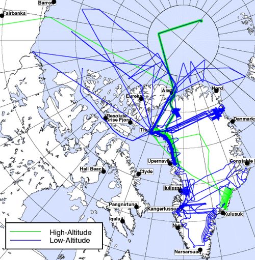
Over the span of almost 10 weeks, crew flew 28 science flights between the DC-8 and P-3 aircraft. Flight paths covered a total of 62,842 nautical miles, equivalent to about 2.5 trips around Earth at its equator. Credit: NASA

IceBridge — the largest airborne survey ever flown of Earth’s polar ice — has now completed two successive Arctic campaigns, adding a multitude of new information to the record from previous surveys.

Continue to follow the IceBridge blog and twitter feed to read updates as science results emerge. Also hear from scientists already planning the return to Antarctica this fall.

IceBridge project scientist Michael Studinger, recently back from the field, offered words of thanks to those who helped made the 2010 Arctic campaign a success.

“A project of this size with two aircraft and multiple deployment sites and a fairly complex instrument payload is only possible with the support of many people. I would like to thank everyone from NASA’s Dryden Aircraft Operations Facility, NASA’s Wallops Flight Facility and NASA’s Earth Science Project Office, who all provided excellent support for Operation IceBridge. We also had excellent support from the NASA instrument teams, the science teams from the universities, and many of our science colleagues, both, from the teams in the field and from people back home in the labs. IceBridge also would like to thank the many people in Kangerlussuag and at Thule Air Base in Greenland who provided excellent support while we were there. We could not have accomplished our goals without their terrific help.”

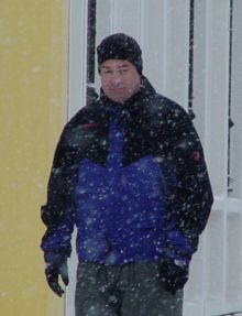
Michael Studinger (right) readies for a science flight from Kangerlussuaq, Greenland, during the Arctic 2010 IceBridge field campaign. Credit: NASA/Jim Yungel

Fasten Your Seat Belts: Mid-Mission Test Flights Complete


From: Michael Studinger, IceBridge project scientist, Goddard Earth Science and Technology Center at the University of Maryland

NASA Wallops Flight Facility, Virginia — During the past week, Operation IceBridge teams have worked at NASA’s Wallops Flight Facility on the eastern shore of Virginia, transferring the science instruments from the DC-8 onto a NASA P-3 Orion aircraft that we will use for the second half of our Greenland campaign. NASA’s fleet of research aircraft allows us to choose the aircraft that is best suited for the science goals that we want to accomplish with IceBridge. We began our work in Greenland with the DC-8 because of its range, load carrying capability, and its ability to fly very high. With the DC-8 we have surveyed the sea ice in the Arctic Ocean and numerous glaciers in northern Greenland. For the second half of the Greenland campaign we will focus on mapping glaciers in southern Greenland using the NASA P-3. The aircraft’s range and maneuverability are ideally suited for low-altitude glacier flying.

The inside of NASA’s P-3 Orion aircraft during installation of Operation IceBridge science instruments at NASA’s Wallops Flight Facility. Credit: Michael Studinger

During the past three months, IceBridge teams from the Center for Remote Sensing of Ice Sheets (CReSIS) at the University of Kansas and Wallops have worked hard to make the impossible possible: designing and manufacturing a complex array of 16 ice-penetrating radar antennas mounted under the wings and the belly of the P-3 and installing and test flying it in only three months! The array of radar antennas is a new development that has never been flown before, allowing us to map heavily crevassed outlet glaciers in unprecedented detail. We will collect several Terabytes of data during each flight that will be processed on a supercomputer at CReSIS when we are back home. The complex array of antennas will allow IceBridge teams to distinguish between radar clutter from surface crevasses and the very weak echo reflected from the base of the glacier of interest. 

NASA’s P-3 research aircraft waits on the ramp at Wallops shortly before taking off for a test flight. The antennas for the ice-penetrating radar system are mounted under the wings. Credit: Michael Studinger

We have now completed a series of mandatory test flights at Wallops to verify the antenna installation and aircraft performance during flight and to check out our science equipment before we leave for Greenland. Research flying has not much in common with everyday air travel. One of the maneuvers that we do during the test flights is to fly the aircraft at a 90° roll angle with the wings perpendicular to the horizon. Fasten your seat belts! You will never experience something like this on a commercial flight. If you do, you might want to consider using a different airline next time.

NASA’s P-3 aircraft during a test flight over Wallops Island, Va. The ice-penetrating radar antennas for Operation IceBridge are mounted under the wings and the belly of the aircraft. Images are courtesy of Rick Hale, CReSIS.

One of the major science goals of Operation IceBridge is to understand the contributions of the Greenland and Antarctic ice sheets to global sea-level rise. During one of the test flights we use the Airborne Topographic Mapper laser system and high resolution aerial photography to map beach erosion on Wallops Island, the location of NASA’s rocket launch facility. Here, at the coast of Wallops Island, rising sea-levels and increased beach erosion are real and need to be considered in long-term planning for the launch facility.

We have now completed all our test flights here at Wallops and are ready to go back to Greenland where we hope to map many of the outlet glaciers and contribute to our understanding and knowledge of future sea-level rise.

Underflying CryoSat-2 at the North Pole


From: Sinéad Farrell, sea ice team member, Earth System Science Interdisciplinary Center at the University of Maryland

The penultimate sea ice flight to be conducted during phase one of the Arctic 2010 IceBridge campaign was exciting. After days of bad weather and confinement to quarters at Thule Air Base, the flight team was finally able to accomplish the remaining sea ice flights. With only three days left in the campaign, and three sea ice surveys to complete, the pressure was on!

Favorable weather conditions on April 20, 2010, meant that the “Sea Ice 07” flight plan could be attempted. For the ad-hoc sea ice team back home, anticipation was mounting. Several days earlier, on April 8, the European Space Agency (ESA) launched the CryoSat-2 satellite to monitor changes in the thickness of polar ice. By April 11, CryoSat-2’s main sensor — the Synthetic Aperture Interferometric Radar Altimeter (SIRAL) — was turned on and meant that an underflight of CryoSat-2 by the DC-8 and its onboard sensors was possible.

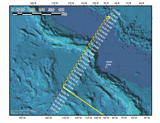
To mitigate against the impact of the drifting sea ice pack, detailed planning and coordination was required to ensure the IceBridge sea ice flight was timed to be coincident with the satellite overpass near-by the North Pole. International collaboration between IceBridge team members at NASA, ESA and NOAA, as well as at a number of academic institutions, ensured the flight was both spatially and temporally coincident with CryoSat-2’s transit across the Arctic Ocean (see map below).


A map of the “Sea Ice 07” flight path, flown on April 20, illustrates the coincident DC-8 flight trajectory (yellow) and the CryoSat-2 orbit (orange) with the times of the satellite over-pass indicated (white). Image is courtesy of Michael Studinger.

Although clouds were encountered en-route to the North Pole, the DC-8 began surveying the CryoSat-2 ground-track just 14 minutes after the satellite passed overhead, in cloud-free conditions. A suite of instruments on the DC-8 including the Land, Vegetation and Ice Sensor (LVIS) and the Airborne Topographic Mapper (ATM) surveyed sea ice elevation along a 465-mile (750-kilometer) CryoSat-2 track at two altitudes: 25,000 feet (LVIS) and 1,500 feet (ATM).

LVIS’s wide swath was particularly suited to capturing the footprint of the satellite’s main sensor. Optical mapping systems, a snow radar, and a gravimeter onboard the DC-8 provided further science data. When analyzed in concert these data provide a valuable baseline for evaluating CryoSat-2’s capabilities for measuring Arctic sea ice thickness.

The flight demonstrated successful collaboration between federal agencies in the United States as well as international cooperation with ESA. Not only did the IceBridge mission carry out the first attempt by aircraft to validate the state-of-the-art radar altimeter onboard CryoSat-2, it contributed to a number of other firsts. The flight marked the most northerly IceBridge survey thus far, utilizing airborne laser and radar altimetry to survey sea ice at a latitude of 88oN. The flight also provided the first opportunity to compare the airborne ATM and LVIS instruments, which use lasers to gather complimentary surface elevation data over sea ice, with a new snow radar system. The sea ice science community looks forward to analyzing the wealth of data gathered during this flight.

Yes,It's Cold in Thule

On April 6, the IceBridge blog received a comment from a first-grade class in response to a March 30 post,”Notes from the Shack.” The class asked a series of questions based on Colleen McIntosh’s words and photos from Thule, Greenland, where she is working as a data analyst and programmer in a GPS Shack during NASA’s IceBridge mission. Answers to the class’ questions, below, were compiled by McIntosh.
Students: How cold is it there?

IceBridge: During the time we have been up here the temperatures have ranged from -12 to 35 F. Typically, like just about everywhere, it is colder in the morning and night, and as the sun rises higher in the sky it warms up. However, on average for the last week or so, it has been around 11 F throughout the day.

Students: Does it ever snow?

IceBridge: Yes it does snow here. However, it is extremely cold and dry up here. When the air is very cold there is a lack of water vapor. Snow is of course made of water, so if it is too dry — even though it may be very cold — it is less likely to snow. And if it does snow it doesn’t snow a whole lot. But since it is so cold up here, when it does snow, it takes a very long time for the snow to melt. So there is snow up here that may be from snowfalls months ago, it just hasn’t melted yet!


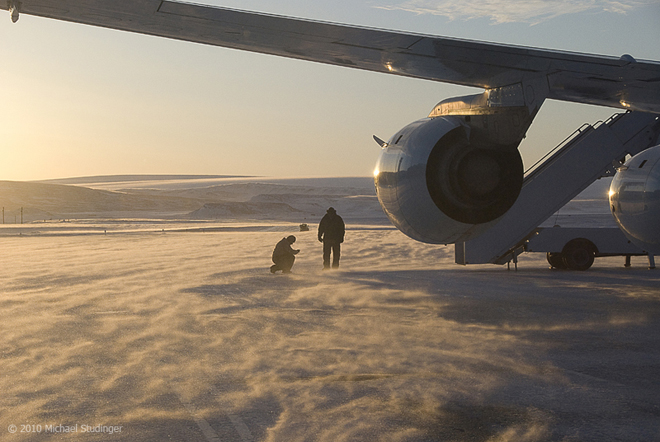
DC-8 crew members Leo Salazar and Scott Silver in blowing snow on the ramp shortly before takeoff from Thule Air Base to the fifth science flight of Operation IceBridge. Credit: Michael Studinger

Students:
How many people are working with you?

IceBridge: It depends on what you mean by working with me … working on the LVIS instrument, there are five of us (including me). On the IceBridge mission, there are about 70 people, however, they are not all up here at once. On average there about 30 people in the IceBridge group in Greenland at one time during this mission. And out of all of those 70 people, only SIX are women!! Also on the entire Air Base in Thule, including contractors, natives, and Air Force people, there are only about 400 to 500 people, only about 75 are women! Oh and there are also children up here as well, most are the native Greenlandic children, but there are a few children who are visiting their mother or father who are stationed up here in the Air Force.

Students: Is it ever springtime there?

IceBridge: They do have all four seasons up here, however spring and fall are very very short compared to winter and summer. During the summer and winter there are about three months where they have either “24 daylight” or “24 nighttime.” And then for about a month before and after winter and summer, it is either quickly getting dark or quickly getting light. And then for around a month or so in fall and spring there is “normal sunlight time.”

Students: Is that mountain made of ice?

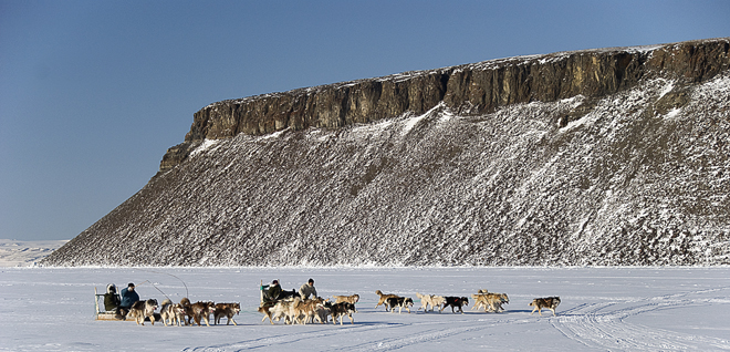
IceBridge: No, Dundas Mountain is made out of rock and dirt, just like mountains we have in the United States. It is just surrounded by and topped with a lot of snow and ice this time of year. You can climb the mountain when it is warm enough, but it is a very hard climb. Toward the top there is even a rope to help you pull yourself up the rest of the way up the mountain because it becomes very steep!

Students: How tall is that mountain?

IceBridge: The mountain is about 700 feet high

Sled dog race in Thule, Greenland, with Dundas Mountian in the background. Credit: Michael Studinger

Students: How far away from where you are standing is the mountain?

IceBridge: It is about 1.5 miles to Dundas Mountain from the GPS shack.

Students: Why does the sun look so big and so close to the Earth?

IceBridge: When celestial objects, like the sun and the moon, they get closer to the horizon and they “appear” bigger. However, this is just an optical illusion. The fact is that the illusion is dependent entirely on the visual cues provided by the terrain when the moon is near the horizon, and the lack of such cues when it’s at the zenith (directly above our heads). To prove this, try viewing the moon through a cardboard tube or a hole punched in a sheet of paper to mask out the landscape — the illusion disappears.

This time of year time of year the sun stays in the sky for almost 24 hours. Come April 17, the sun will not set here for the next three months. This is because of the way the Earth is tilted. Right now the Earth is tilting toward the sun, and because Greenland is just about at the top of the world, the Earth’s top always sees the sun. But something to note is that although the sun does not set for three months, the temperature still only reaches 60 degrees at its hottest!

Students: How do you make electricity?

IceBridge: There are several diesel generators that power the entire base. Also on the base are several cylindrical containers that hold the fuel for the airplanes that land and take off from this base. There used to be a lot more containers, but now that the base isn’t used as much as it was in the 1950s and 1960s, they have taken out these containers.


Operation IceBridge Off to a Successful Start in Greenland

From: Michael Studinger, IceBridge project scientist, Goddard Earth Science and Technology Center at the University of Maryland

Hello and a warm welcome to all blog readers from the IceBridge team here at Thule Air Base in northern Greenland. After taking off on Sunday night from NASA Dryden’s Aircraft Operations Facility in Palmdale, Calif., the NASA DC-8 arrived at Thule Airbase on Monday afternoon. Both the aircraft and science teams have done an incredible job in setting up operations in record time here in Thule. 


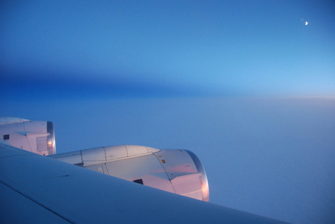
The moon and sunrise are visible over the Arctic Ocean during the flight from Palmdale, Calif., to Thule, Greenland. Credit: Michael Studinger

We were able to take off for an eight-hour science flight on Tuesday morning to survey the sea ice in the Arctic Ocean north of Ellesmere Island. Wednesday’s science flight was targeted at several glaciers north of Thule. Some of the glaciers have been surveyed for the first time last year and we are back this year to monitor the changes that have occurred since last spring. We begin the day with flying over a small glacier called Heilprin Glacier. We are very early in the season and the sun is just above the horizon in the morning hours, illuminating the coast of Greenland with its frozen fjords, icebergs and glaciers in a beautiful light. 


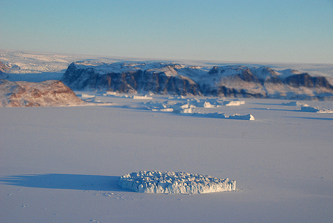
The sun is very low and only barely above the horizon at the beginning of the third science flight, creating beautiful illumination of the cost of Greenland with its frozen fjords, icebergs and glaciers. Credit: Michael Studinger

After an hour of flying we begin to fly a grid pattern in the catchment area of Petermann Glacier to measure the thickness of the ice with a radar system from the University of Kansas. These data will be used as input for computer models that will allow us to better predict how the Greenland ice sheet will respond to environmental changes in the Arctic.

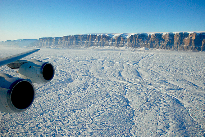
We continue our flight by repeating two survey lines along Petermann Glacier that have been surveyed several years before. The scenery with the steep sidewalls is spectacular. We can see huge meltwater channels on the surface that will be filled with water running down the glacier when the Arctic melt season starts in a few months. 


The IceBridge crew fly down Petermann Glacier in northern Greenland with NASA’s DC-8 aircraft. Credit: Michael Studinger

After completing the flight lines over the Petermann Glacier we turn back towards Thule Air Base and measure the ice surface elevation with a laser altimeter along a track that has been measured many times by NASA’s ICESat satellite. We are heading back to Thule Airbase to land before the tower and airfield close for the day. 


At the end of a day of glacier flying, Dundas Mountain — a major Greenland landmark — can be seen during the approach to Thule Air Base. Credit: Michael Studinger

We have had an incredibly successful start of the 2010 Arctic campaign. We have been able to collect LVIS laser data along the transit from California to Greenland and have been flying 3 days in a row collecting huge amounts of data. A storm system here in Thule has forced us today to stay on the ground and everyone is catching up with sleep and data processing. With a little bit of luck we hope to fly the DC-8 again on Friday. Thanks to all the aircraft and science teams, the staff at Thule Air Base, and many people back home who have made such an incredible start of the IceBridge 2010 campaign possible!