By Michael Studinger, IceBridge Project Scientist, NASA Goddard Space Flight Center
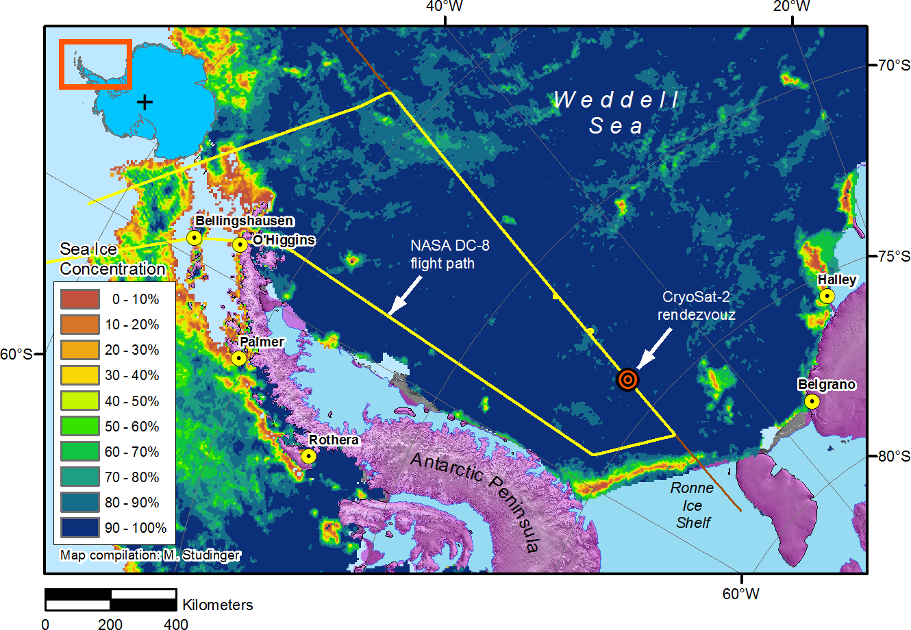
Punta Arenas, Chile – Better understanding of changes that occur in the polar ice sheets and sea ice requires observations over many years. With Operation IceBridge we make sure that there are no gaps in these critical measurements. In particular, we “bridge” the gap in laser altimeter measurements from space between ICESat, which ended in 2009, and the follow-up mission ICESat-2, which will launch in 2016. Using data from these two satellite missions and combining them with our aircraft measurements we will be able to build a time series of measurements that spans 17 years. In order to build long time series we often have to combine measurements from different instruments and satellites and it is important to make sure we calibrate and validate these measurements against each other, which will allow us to detect changes in the polar ice sheets and sea ice. The goal of Thursday’s IceBridge mission into the Weddell Sea was to better understand how radar altimeter measurements from ESA’s CryoSat-2 satellite can be combined with laser altimeter measurements from NASA’s IceBridge satellites.
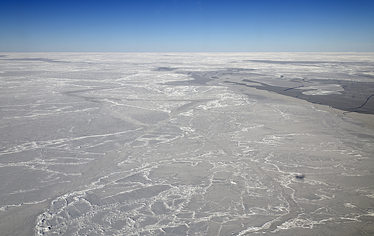
Scarred and chiseled sea ice in the Weddell Sea, where the DC-8 followed in CryoSat-2’s tracks on Thursday’s IceBridge flight. The DC-8’s shadow appears as a dark speck in the lower right. Credit: Michael Studinger/NASA
With IceBridge we are in a unique position to answer these questions because we fly both kinds of instruments on the DC-8 aircraft. In order to compare our measurements we have to fly the DC-8 directly beneath the CryoSat-2 satellite and collect data at the same time in the exact same location. It sounds easier than it is. Many things have to come together to make this happen. First, the weather in the Weddell Sea needs to be suitable for our flight. We need a large, cloud-free area beneath us, which is very rare to find. Second, we need the CryoSat-2 spacecraft on an orbit that allows us to take off from Punta Arenas and fly the DC-8 on the satellite ground track at the same time the spacecraft passes overhead. Third, we need this location to be over a certain type of sea ice that is suitable for comparison of the different measurements. Last, but not least, the weather conditions in Punta Arenas have to be suitable for safe takeoff and landing. Today, we were facing very strong winds that have been close to preventing a flight. While we were flying over the Weddell Sea our colleagues informed us that the winds in Punta Arenas had become so strong that the G-V aircraft had to be moved to Puerto Montt because the wind conditions exceeded the safety specifications for safe parking on the ramp for the G-V. All in all, flying an aircraft directly beneath a satellite in one the most remote parts on Earth is far from trivial. Today, everything went well and the DC-8 flew along the CryoSat-2 ground track in the southern Weddell Sea while the spacecraft passed overhead. The ice conditions were just perfect.
After our rendezvous with CryoSat-2 we reversed course on the ground track to fly back on the same line for 130 kilometers. We did repeat measurements over the exact same segment of our survey line over the course of one hour in order to track the drift of the sea ice. Wind and ocean currents move sea ice floes around. We can estimate how fast and in which direction the sea ice is moving by correlating patterns in our data between the three passes. It is very difficult to make these measurements from space.
After reaching the northern end of our survey line we transit back to Punta Arenas, knowing that we accomplished another landmark sea ice mission for Operation IceBridge.